ADVENTURE HIKES AND CANYONEERING
IN THE SOUTHWEST
© Christopher Earls Brennen

|
|---|

|
Hike H3. Indian Canyon
- Hiking time: 8 hours
- Estimated hiking distance: 7.7 miles
- Elevation gain: 3300 feet
- Topo Map: Yosemite National Park Topographical Map
- Difficulties: Strenuous hike up, much rock scambling and one tricky downclimb
- Special equipment: 25ft webbing or rope
-
ACA Rating: 2A III

Characteristics
It was Abraham Lincoln who set a marvellous precedent for the world when he signed the bill in 1864 establishing Yosemite as the nation's first state park; twenty six years later it became a National Park. And yet the magnificence was revered before the white man ever set foot in this land of spectacular natural beauty. The Yosemite Indians who lived on the floor of the valley not only wondered about the awesome monuments around them but used them to protect themselves from the incursions of the white men.
During the second military expedition against the Yosemites in 1851, the force under Captain Boling camped in the valley for an extended period and, from there, they launched many sorties in search of the elusive Yosemites. One of the sorties took them up Indian Canyon to the high tableland where they suspected that the remnants of Chief Tenaya's band were hiding. The chief himself was a prisoner of Captain Boling's troop and was required to go along on the sortie. In his "Discovery of the Yosemite" (1880) one of the participants, Lafayette Bunnell, describes how the wily old chief, who continually tried to mislead his captors, attempted to dissuade them from the Indian Canyon climb, claiming that "the ravine was a bad one to ascend". They also severely underestimated the height of the climb. Indeed, Captain Boling, who had been ill, was unable to make it all the way and Bunnell was delegated to lead a small group to the top. But, Bunnell does not describe the canyon as presenting any major obstacles other than "wet mossy rocks". Elsewhere in his book, Bunnell expounds: "The ravine called Indian Canyon is less than a mile above Yosemite Fall; between the two is the rocky peak called the "Lost Arrow," which, although not perpendicular, runs up boldly to a height of 3030 feet above the level of the Merced. The Indian name for the ravine ... was Le-Hamite, and the cliff extending into the valley from the east side of the canyon is known as the "Arrow-wood Rocks". This grand wall extends almost at a right angle towards the east, and continues up the Ten-ie-ya Canyon, forming the base of the North Dome.."
In "Discovery of the Yosemite" Bunnell describes the view: "The grandeur of the scene was but softened by the haze that hung over the valley - light as gossamer - and by the clouds which partially dimmed the higher cliffs and mountains. This obscurity of vision but increased the awe with which I beheld it, and, as I looked, a peculiar exalted sensation seemed to fill my whole being, and I found my eyes in tears with emotion."
In 1869, eighteen years later, John Muir spent "My First Summer in the Sierra" in Yosemite. He used Indian Canyon as a way to get down into the valley from the high country to the north. On the first occasion he was motivated to meet Professor Butler and "I made my way through the gap discovered last evening, which proved to be Indian Canyon. There was no trail in it, and the rocks and brush were so rough that Carlo [his dog] frequently called me back to help him down precipitous places."
This strenuous adventure hike involves the ascent of the famous Upper Yosemite Falls trail followed by visits to two of the most spectacular overlooks anywhere in the world. You then hike to a trail crossing of Indian Canyon Creek where you leave the trail and descend Indian Canyon. The descent is not technical but involves much boulder scrambling and one tricky downclimb for which it is wise to carry a short length of webbing or rope. The hike is good for the summer or early fall but an early start is recommended in the summer to avoid the intense heat during the initial ascent. Take plenty of water or a water filter.
Trailhead
This hike begins at the Upper Yosemite Falls trailhead located in the parking lot for the Sunnyside Campground in Yosemite Valley (37o44.56'N 119o36.15'W). Most likely you will have to leave your vehicle in the Daytime Parking Area beside Yosemite Village. This is convenient for the end of the hike but about a mile from the starting point. You can either walk to the trailhead or catch a shuttle bus to Shuttle Stop 7 at Sunnyside campground.
Hike
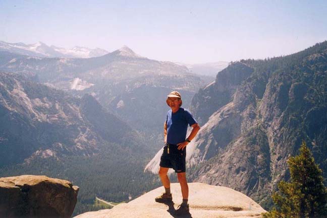
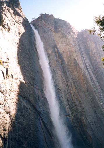
From the Sunnyside Campground parking area (37o44.56'N 119o36.15'W and elevation 4000ft) follow the signs for the Upper Yosemite Falls trail. This rocky trail switchbacks back and forth in the shade of trees as it climbs to a wooded ledge about 1000ft above the valley floor. About 45min from the start you should reach an overlook at 5080ft that provides a great view of the valley, with El Capitan off to the right and Half Dome to the left. After this initial climb there is a welcome level or slightly downhill section as the trail contours east along the ledge. Turning a corner about 1hr from the start you are greeted by a fantastic view of the Upper Yosemite Falls. Yosemite Creek drops more than 1400ft from the valley rim to a ledge above the Lower Falls. During its descent the water splinters into showers generated by ballistic fingers, billowing curtains and wispy eddies. The Falls are most spectacular early in the season.
 | 
| |
|---|---|---|
| View from Yosemite Falls overlook | Upper Yosemite Falls |
There are a number of different viewpoints along the trail each of which seem to demand a few minutes of wonderment. Too soon, however, as the trail moves into the corner to the west of the falls, the switchbacks begin again and you climb into a steep valley hidden in a cleft to the west of the falls. The last set of switchbacks is most exposed to the sun and represent the toughest challenge of the day. About 1.5hr and 3.6mi from the start you come to the top of this climb at a gate and trail junction at 37o45.58'N 119o35.96'W and an elevation of 6540ft. Go right at this junction following the signs for North Dome; after just 0.1mi, be sure to fork right again in order to make a visit to the Yosemite Falls Overlook. Once there follow the steep and airy stairway down to the end of the overlook, where you can peer straight down the Upper Falls. It is an awesome spectacle, one which will make even the most experienced climber cling to the handrail.
Returning from the excursion to the overlook, turn right and follow the trail down to the bridge (37o45.52'N 119o35.80'W) over Yosemite Creek just upstrean from the Falls. You should reach this point about 3hr from the start. It is a beautiful place to rest and cool off.
Continuing eastwards, the trail switchbacks up the side of a low slickrock ridge and then contours out to where the ridgetop meets the valley rim. This is the location of another great overlook, Yosemite Point, some 3000ft vertically above the valley floor. Here you get a great view of Half Dome, previously hidden behind the ridge. You should reach Yosemite Point (elevation 6850ft) about 3.5hrs from the start.
 | 
| |
|---|---|---|
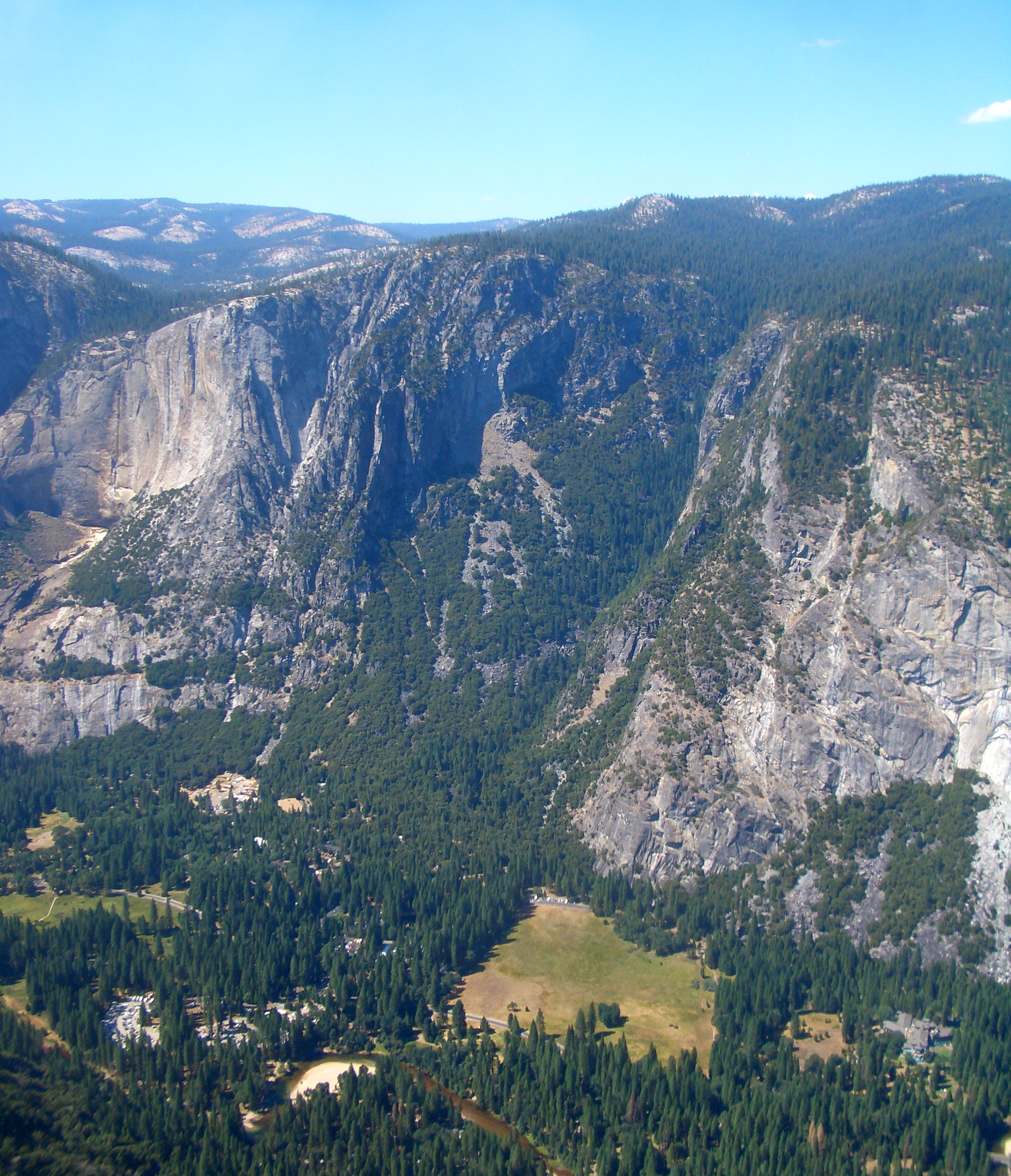
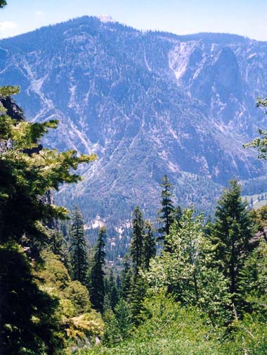
| Indian Canyon from Glacier Point | Looking down Indian Canyon |
From Yosemite Point the last ascent of the day takes you up over the top of the ridge (elevation 7240ft) from where you begin a gentle descent down through forest into Indian Canyon. A little over 4hrs and about 5.9mi from the start, you arrive at the stream crossing of Indian Canyon Creek (37o46.30'N 119o34.87'W and elevation 6910ft), a bucolic spot in a small wooded valley. Take a break here and prepare for the rugged off-trail descent of Indian Canyon ahead of you.
As you leave the trail and start down along Indian Canyon Creek, the intitial gradient is modest and the way is easiest some distance up the bank from the stream. Start on the left side, cross to the right and then back to the left. About 25min into the descent at an elevation of 6610ft, the canyon suddenly steepens and narrows. Ahead you get your first view of the valley far below you. Cross to the right side and work your way down the steep canyon using a faint animal trail along the rock and earth streambank. At 6310ft and 5hrs from the start, the canyon continues to descend steeply. About here the author followed a long detour on the right along and old, dry and somewhat overgrown streambed that may have bypassed some tricky downclimbing in the main channel. At the end of the detour, I came to a narrow section in the canyon where I encountered a bear on his way up the canyon; we passed without incident.
At an elevation of around 5600ft the canyon becomes less brushy with more trees and larger boulders. Here a little route finding is needed in places. Shortly thereafter at 5350ft the canyon slope decreases though there are still downclimbing challenges. The stream continues to flow but do not count on it for it disappears underground at about 5150ft and 6hrs from the start. For the next 40min you must deal with quite a bit of bouldering that culminates at 4680ft and almost 7hrs from the start in the only real downclimbing challenge in Indian Canyon. A row of huge boulders has generated a drop of about 25ft in the streambed. To descend find the gap on the far left and climb down through a slot onto a broad flat ledge with a 15ft drop all around it. Get out your webbing or short rope and follow the narrow ledge on the left out to a small but stout tree growing horizontally out of the rockface. Sling this with the webbing or rope to aid the downclimb using footholds on the apex of the rockface.
Downstream of this hurdle, the route becomes easier. The stream reappears
at about 4450ft and a short distance beyond this the canyon broadens
with easy going through forest on the left. At 4130ft and
7.5hrs and 7.7mi from the morning start you should come to
an asphalt path that goes to the left of the medical center. This quickly
brings you to a main park road
at 37o44.90'N 119o34.92'W.
Turning right, the road will soon take you
to Yosemite Village and the Daytime Parking Area. The total duration of the
hike is about 8hrs.
Last updated 6/21/04.
Christopher E. Brennen