ADVENTURES AROUND THE WORLD
© Christopher Earls Brennen

Hike I7. Bungle Bungles
- Hiking time: Short hikes of about 1 hour each
-
Estimated hiking distance: About 1.3 miles (2 kilometers)

- Elevation gain: Very small.
- Topo Map: Purnululu National Park, Western Australia
- Difficulties: Heat, dehydration
- Special equipment: None
- Permit: None. However, the park is administered by the Kitja people and contains many sites sacred to them. Visitors should stay on the established trails not only out of respect for the Kitja and sites but also to avoid damage to the fragile rock formations.
- ACA Rating: 1AI
Characteristics
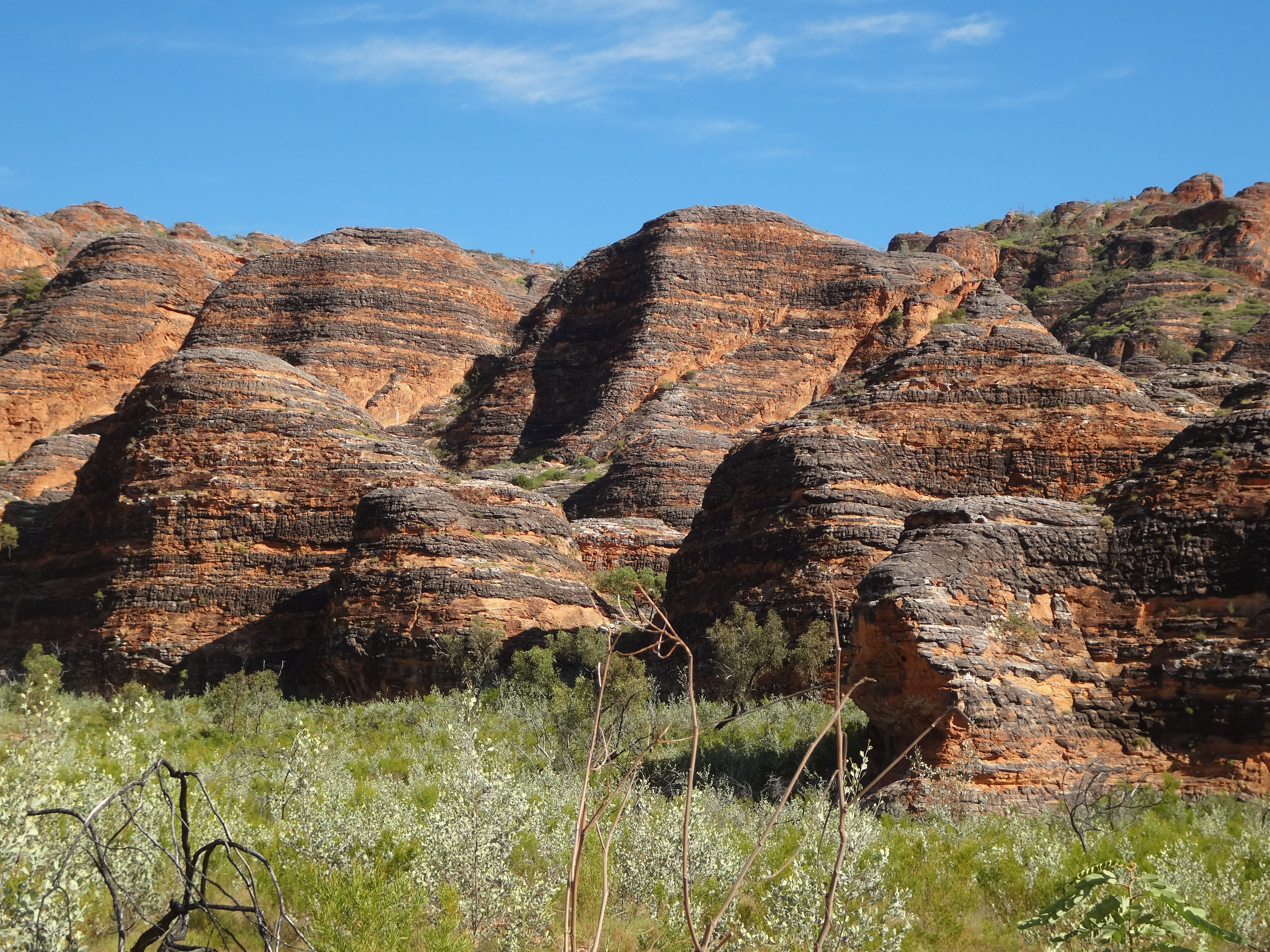
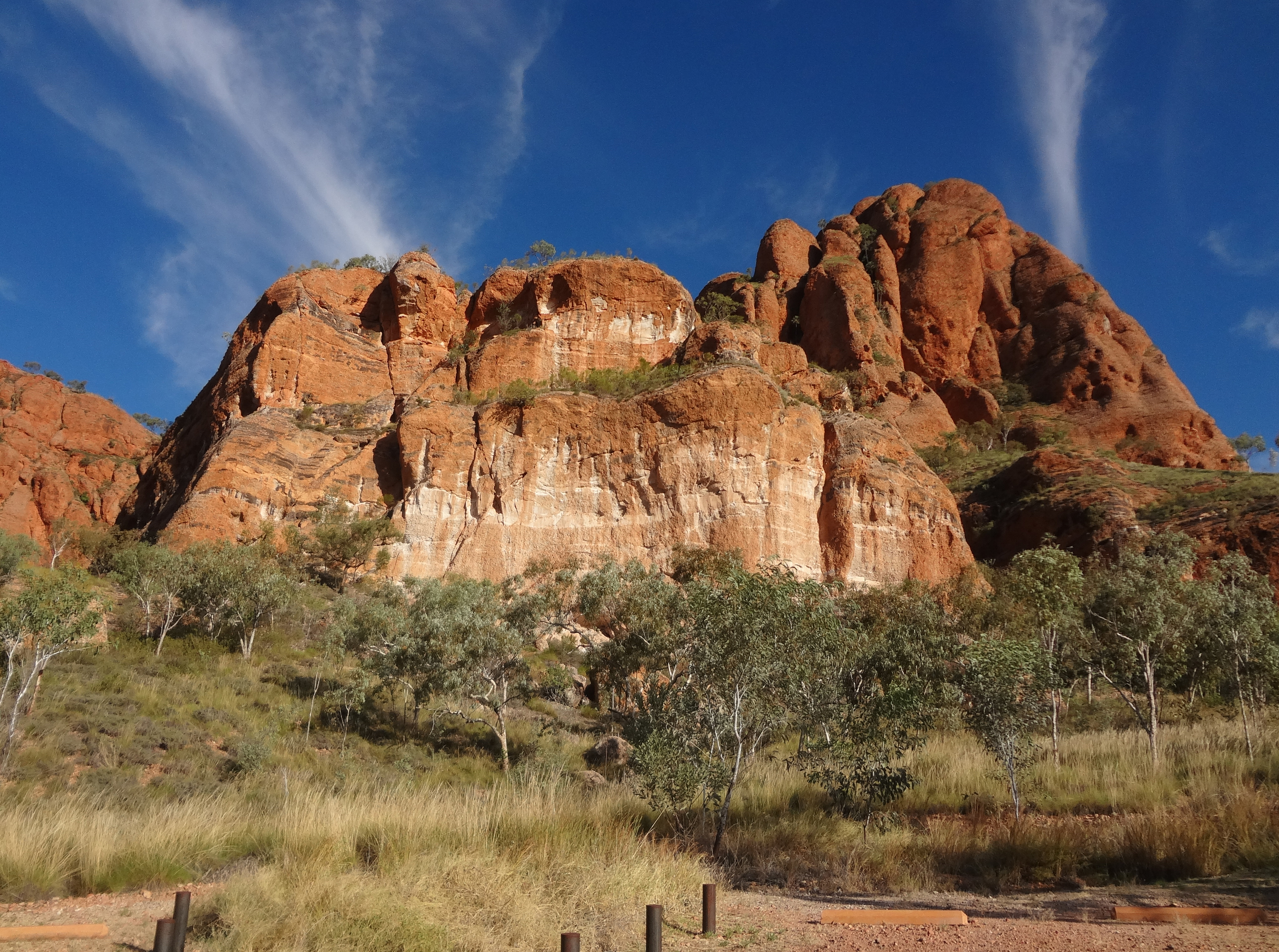
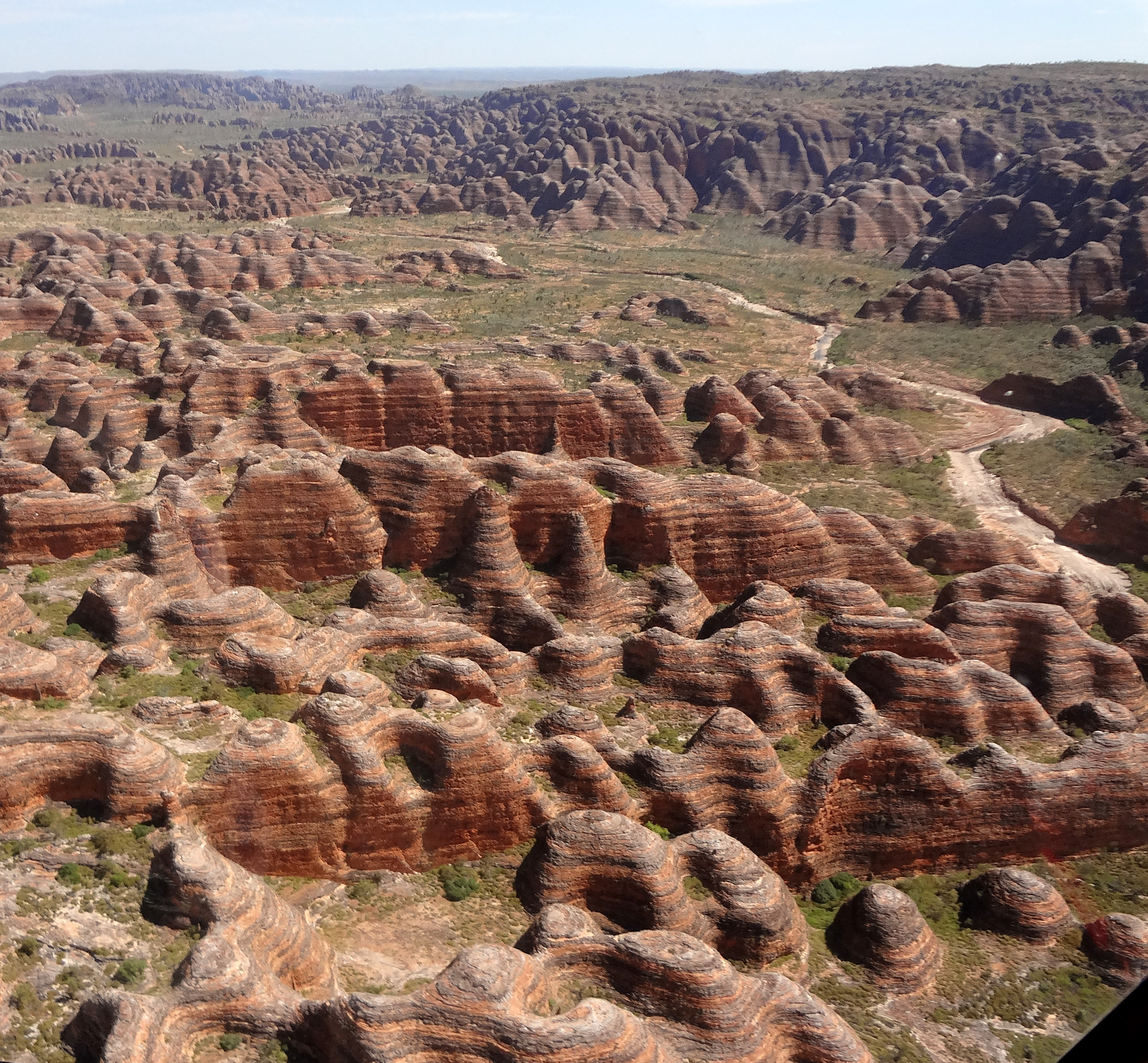
The Aboriginal people of this section of the Kimberley region of Western Australia, the Kitja people, called this place Purnululu or ``sandstone''. It is now the Purnululu National Park and is reknowned for its remarkable sandstone erosion patterns that have produced an array of striped sandstone domes or beehives. It is the most extensive and impressive occurrence of this kind of sandstone tower (or cone) karst terrain in the world. The feature is known as the ``Bungle Bungles'' which may be a corruption of ``bundles'' referring to bundles of cordon grass. The park lies within the traditional homeland of the Kitja people.
| 
| |
|---|---|---|
| Bungle Bungle domes at Piccaninny trailhead | Bungle Bungle domes at Piccaninny trailhead |
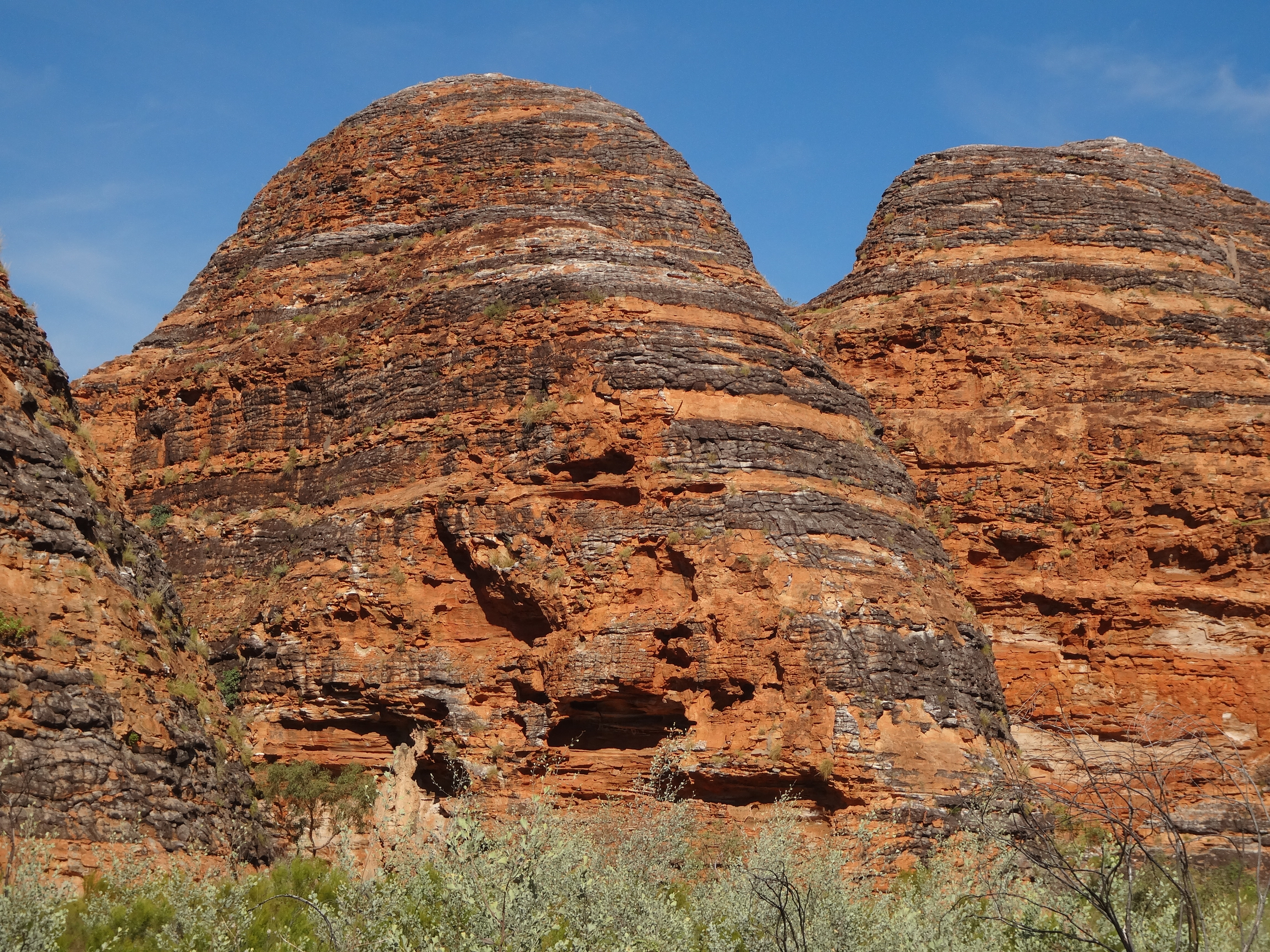
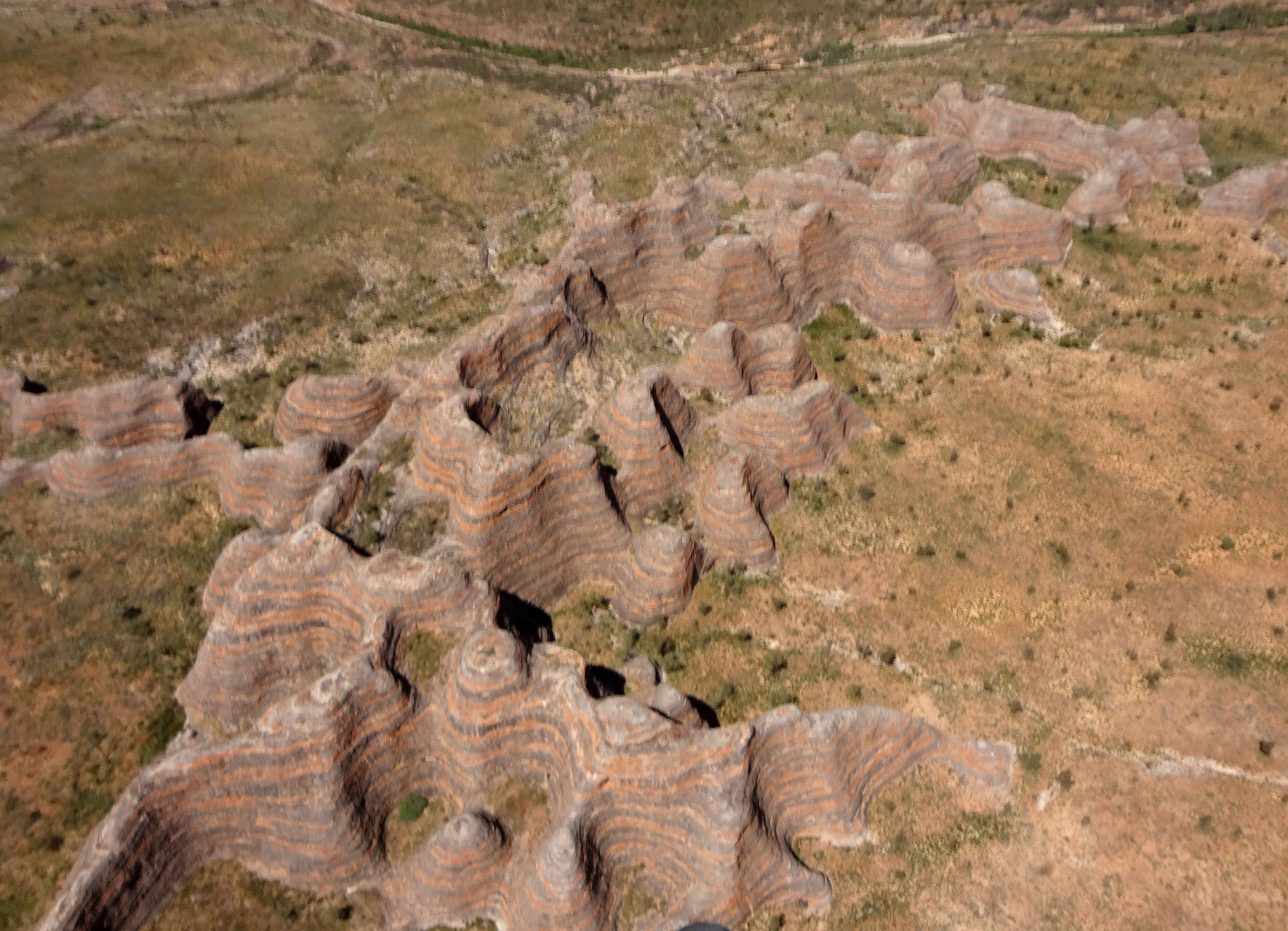
The unusual and striking sandstone domes are remarkable for their shape, number and size and for their remarkable alternating bands of orange and grey. The horizontal banding is due to differences in the clay content and porosity of the sandstone layers: the orange bands consist of oxidised iron compounds in layers that dry out too quickly for cyanobacteria to multiply; the grey bands are composed of cyanobacteria growing on the surface of layers of sandstone where moisture accumulates. The surface of the domes is fragile but stabilized by crusts of iron oxide and bacteria. They provide an outstanding example of land formation by dissolutional weathering of sandstone.
The Bungle Bungles are a plateau of Devonian sandstone whose edges were carved into a mass of these beehive shapes. The erosion also extended further into the plateau resulting in a series of deep, sheer-sided gorges and slot canyons, some 100–200m (300-600ft) deep that penetrate the plateau. The hikes described below explore two of the most impressive of these canyons while the helicopter flight provides an impressive overview of the entire plateau.
Trailhead
The only vehicle access to Purnululu National Parkark is by way of a very rough, 53km (33mi) long dirt road known as the Spring Creek Track, that branches off from the paved Great Northern Highway approximately 107km (68mi) north of the town of Halls Creek or 250km (160mi) south of the town of Kununurra in Western Australia. The road is only passable by four-wheel-drive (4WD) vehicles and only during the dry season (about April 1 to December 31). It takes about two hours to drive from the Great Northern Highway to the Visitor Center at the entrance to the park. However, helicopter and light aircraft tours are available from a number of surrounding airstrips including Kununurra and Warmun. The airstrip in the park is known as the Bellburn Airstrip and is the base for the local helicopter tours.
Just beyond the Visitor Center the park road forks at -17.42586oS 128.30469oE. The left fork proceeds northwards and passes the area of the campgrounds (-17.38643oS 128.33162oE) before accessing the northern end of the plateau and the featured hike into the Echidna Chasm from the trailhead of the same name at (-17.32299oS 128.41206oE) and about 19km from the Visitor Center. The right fork proceeds past the Bellburn Airstrip (17km from the Visitor Center) and around the southern end of the plateau before accessing the Cathedral Gorge trailhead at 17o29.34'S 128o22.50'E about 26km from the Visitor Center.
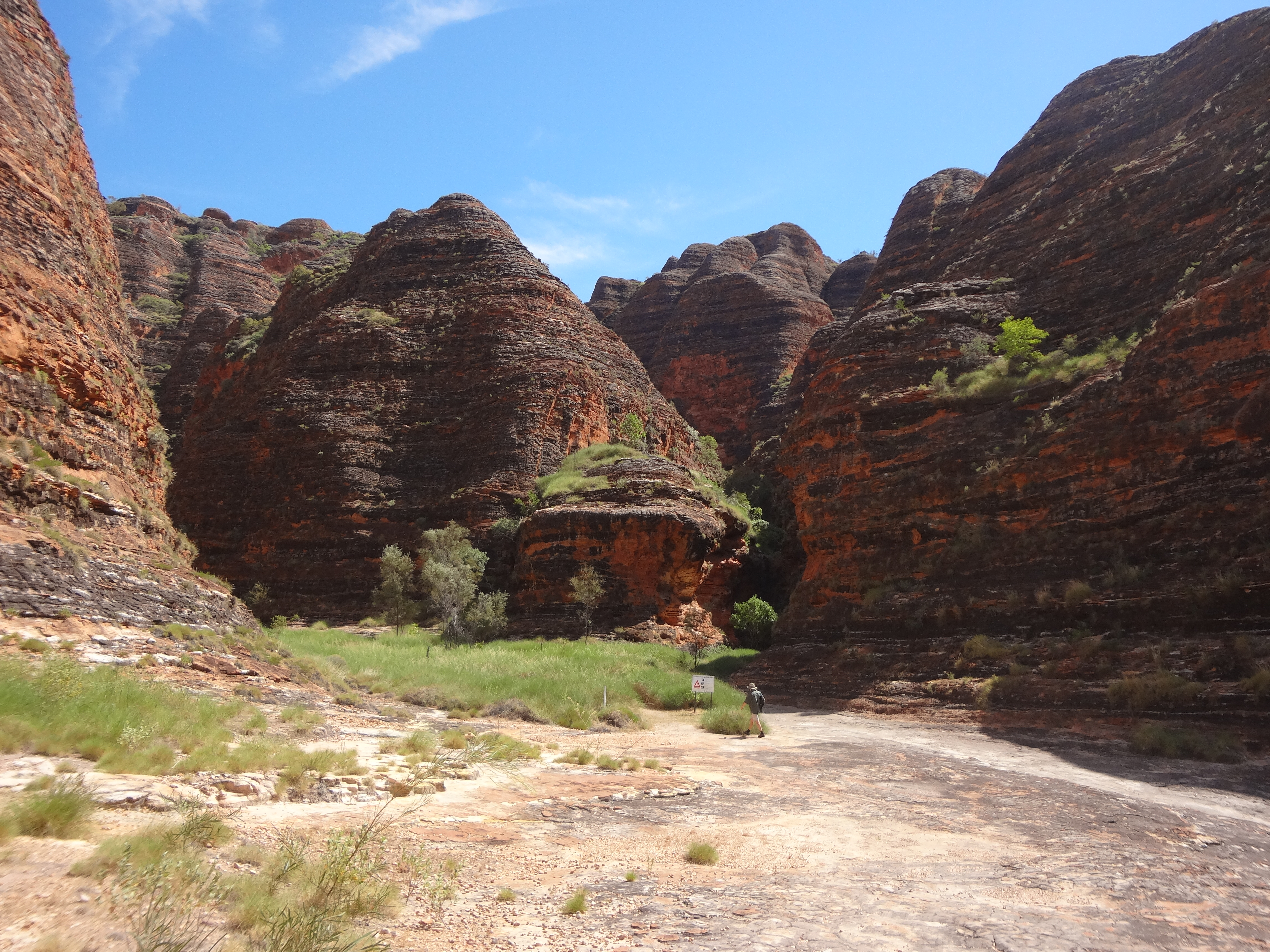
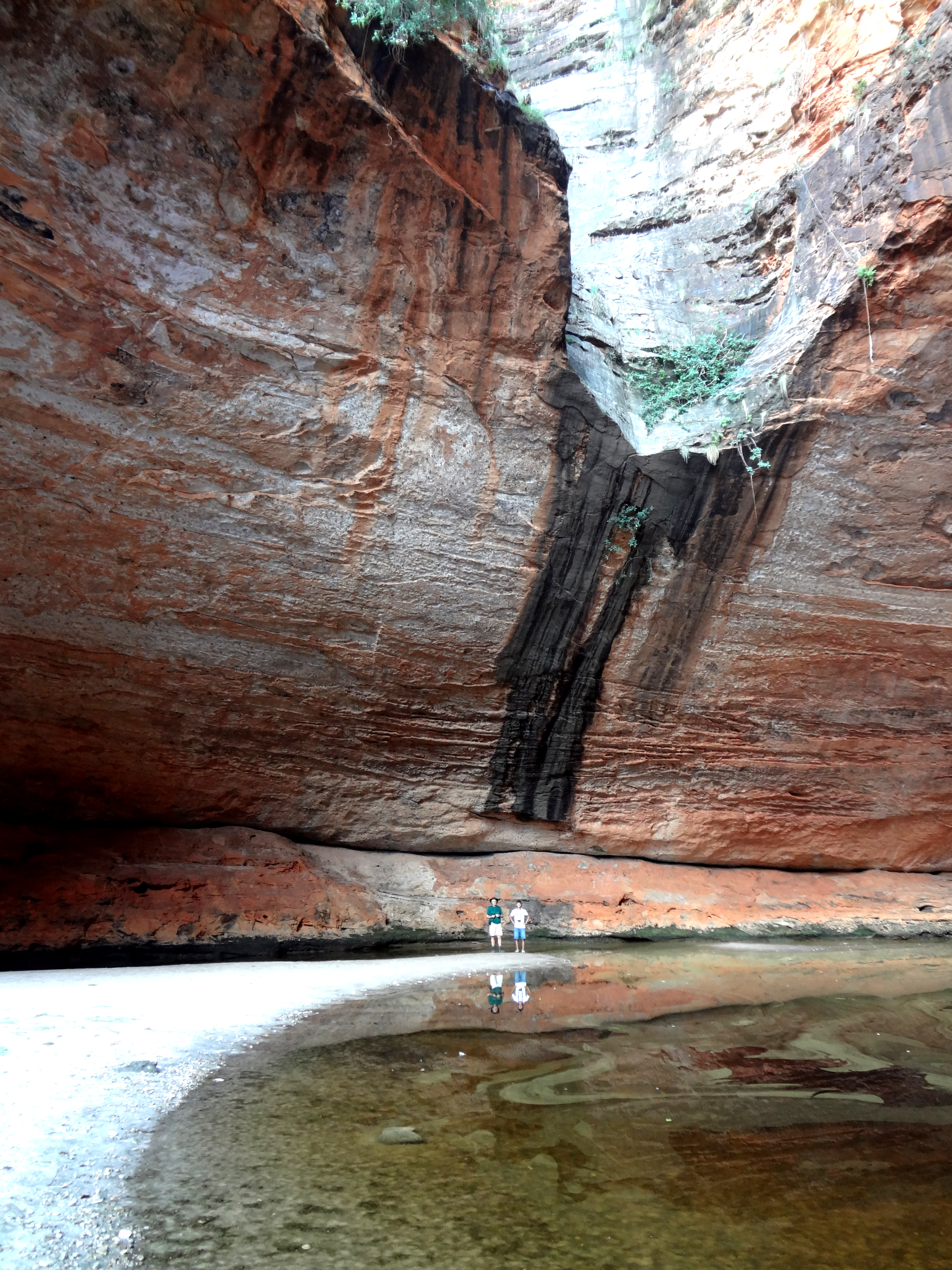
Cathedral Gorge Hike
| 
| |
|---|---|---|
| Approaching Cathedral Gorge | In Cathedral Gorge |
To access the Cathedral Gorge and Piccaninny Creek trailhead, turn right at the fork just beyond the Visitor's Center at -17.42586oS 128.30469oE and drive 26km around the southern end of the Bungle Bungles to the end of the road at the trailhead (-17.48948oS 128.37503oE). The trails from here are all well described on the display boards. We recommend the Cathedral Gorge hike with an optional branch hike to the Piccaninny Creek Lookout. For the Cathedral Gorge follow the marked trail with an uneven surface down a dry creek bed exposed to the sun before forking left where the Piccaninny Creek forks right. You pass some of the marvellous sandstone domes as you enter the gorge and gain some welcome shade from the desert sun. The spectacular, red-walled sandstone gorge narrows and the trail negotiates some steep but short steps before culminating in an awesome, natural amphitheatre with a permanent pool. The distance from the trailhead to the amphitheater is about 1km and the one-way hike takes about 25min.
If you choose to visit the Piccaninny Creek Lookout on the return from the Gorge then fork left at the aforementioned trail junction midway between the Gorge and the trailhead. The trail follows the deeply eroded and rough Piccaninny Creek bed for about 200m before turning right and leaving the creek bed. The trail then gradually ascends through the brush and unexpectedly emerges at the elevated Piccaninny Creek lookout with views across the Piccaninny Creek as it winds south through spinifex hummocks towards the Ord River. It takes an additional 20min to hike from the trail fork to the lookout, an additional distance of about 0.4km.
| 
| |
|---|---|---|
| Cathedral Gorge amphitheatre | Echidna "scratches" |
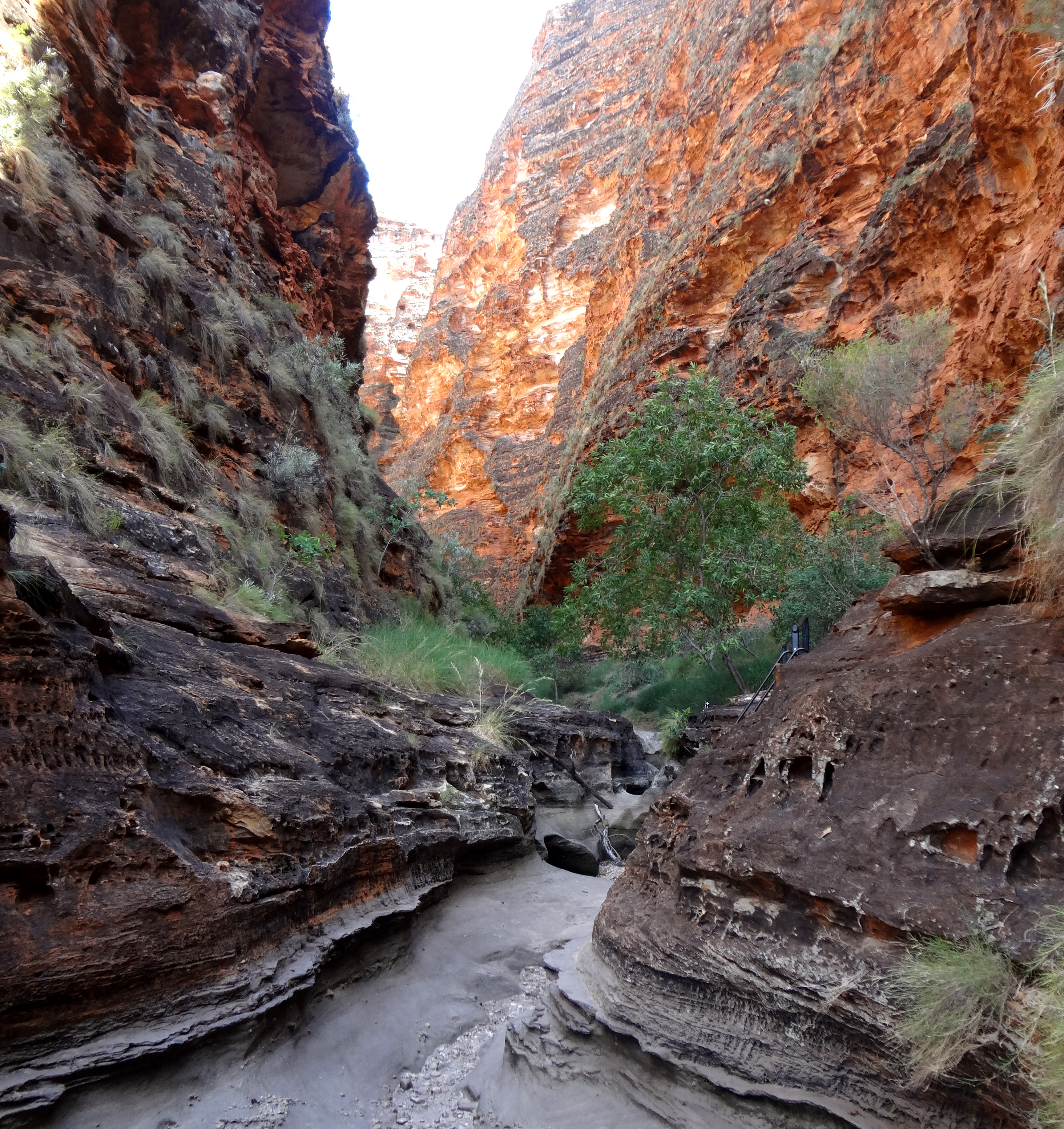
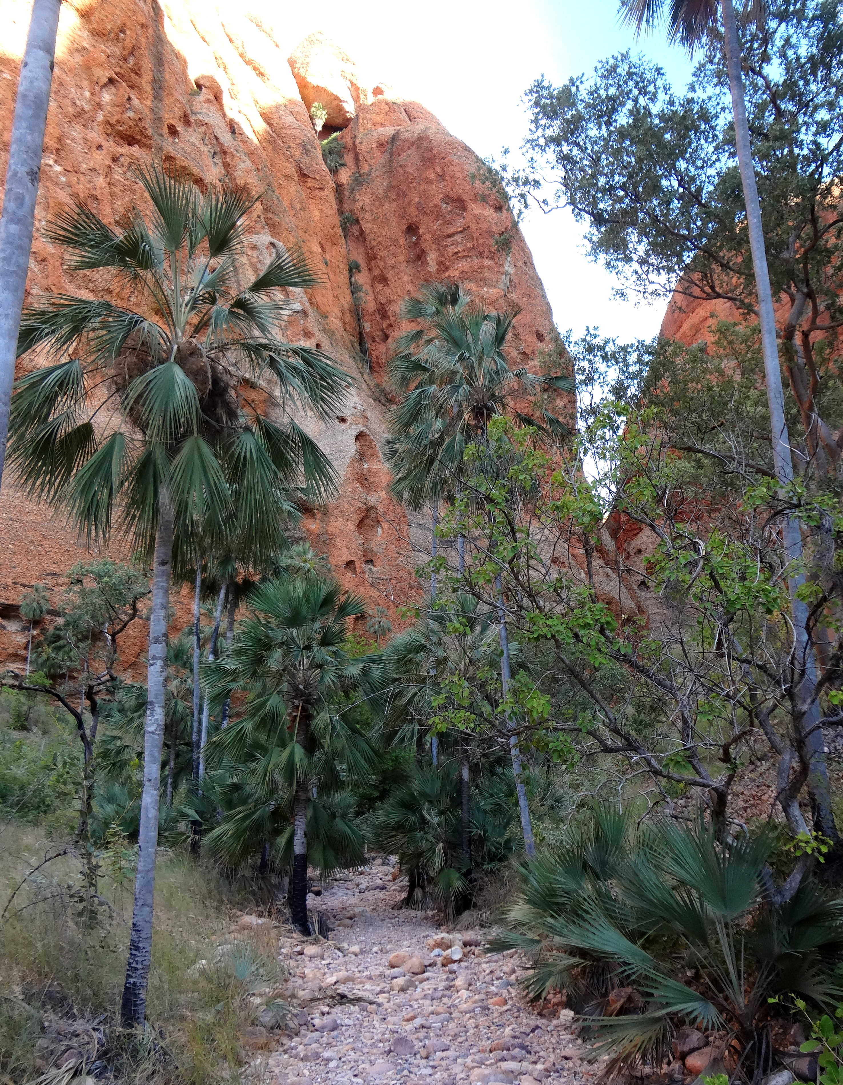
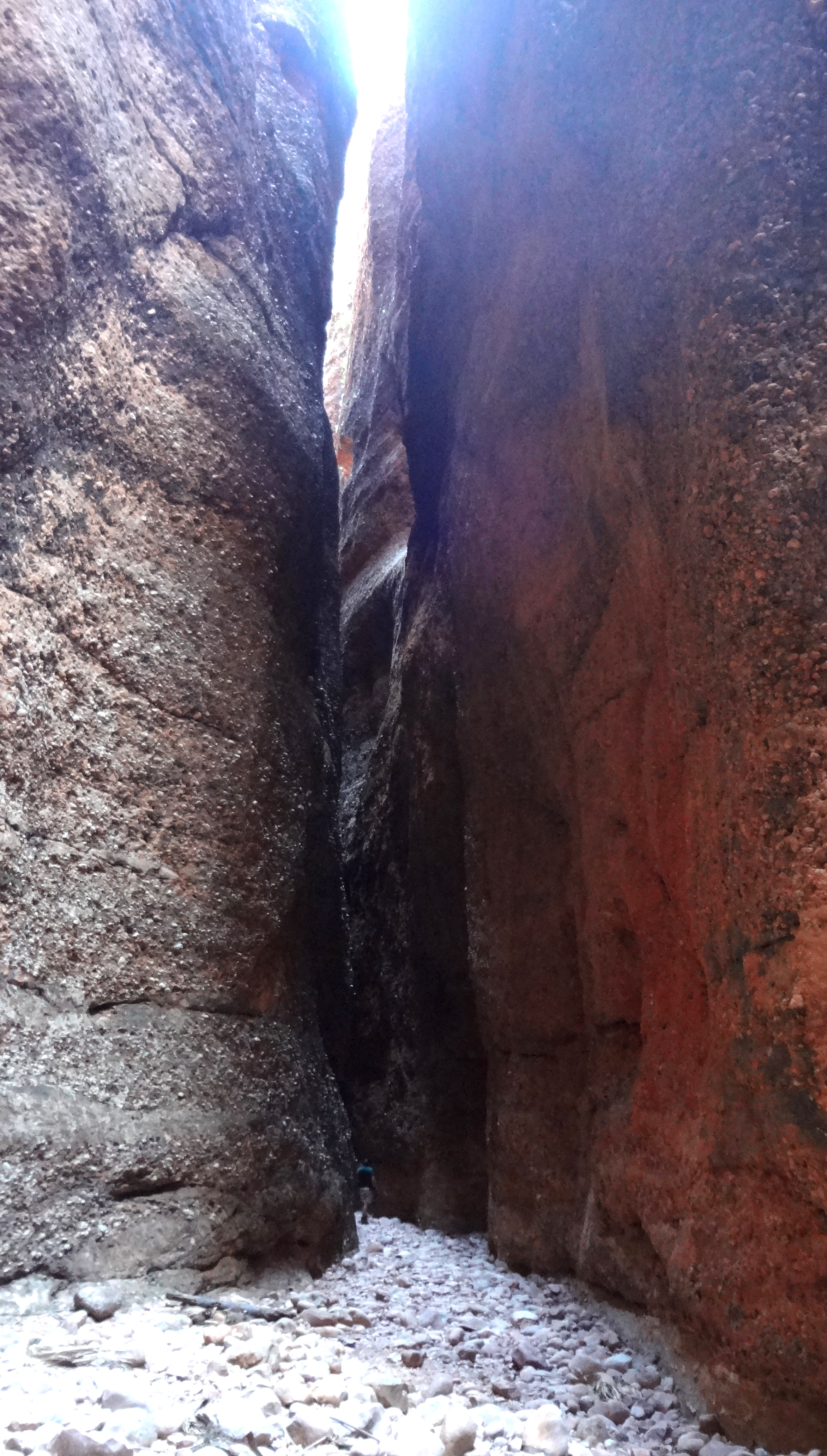
Echidna Chasm Hike
To access the Echidna Chasm, turn left at the fork just beyond the Visitor's Center and drive 19km to the northern end of the Bungle Bungles and the Echidna Chasm trailhead at -17.32299oS 128.41206oE. From the trailhead look up at the cliff that towers over you and you will see the ``scratches'' that the aboriginals attributed to a giant Echidna and led to the name of the Chasm. The trail from there into the Chasm is well marked but hot and exposed along a very uneven, stony, dry creek bed. Because of the heat the hike is best in the early morning or late afternoon. The last 100m in the narrow, 1m wide, 180m deep chasm requires scrambling over boulders and climbing ladders. It takes about 25min to hike the roughly 0.7km distance to the end of the chasm.
| 
| |
|---|---|---|
| Echidna Chasm | Echidna Chasm |
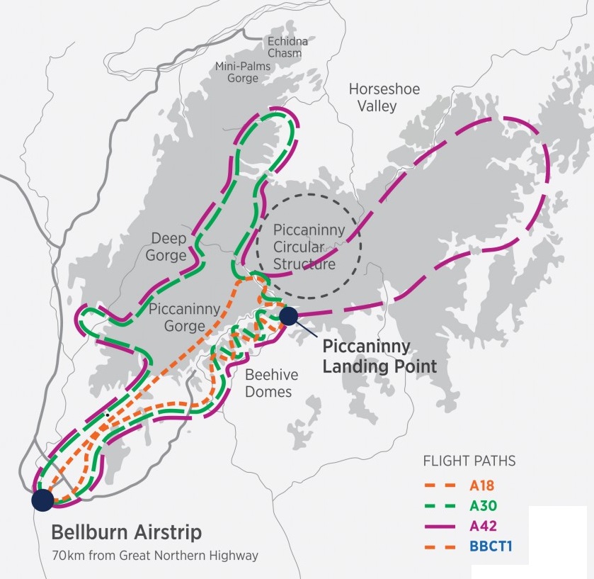
Helicopter Tour
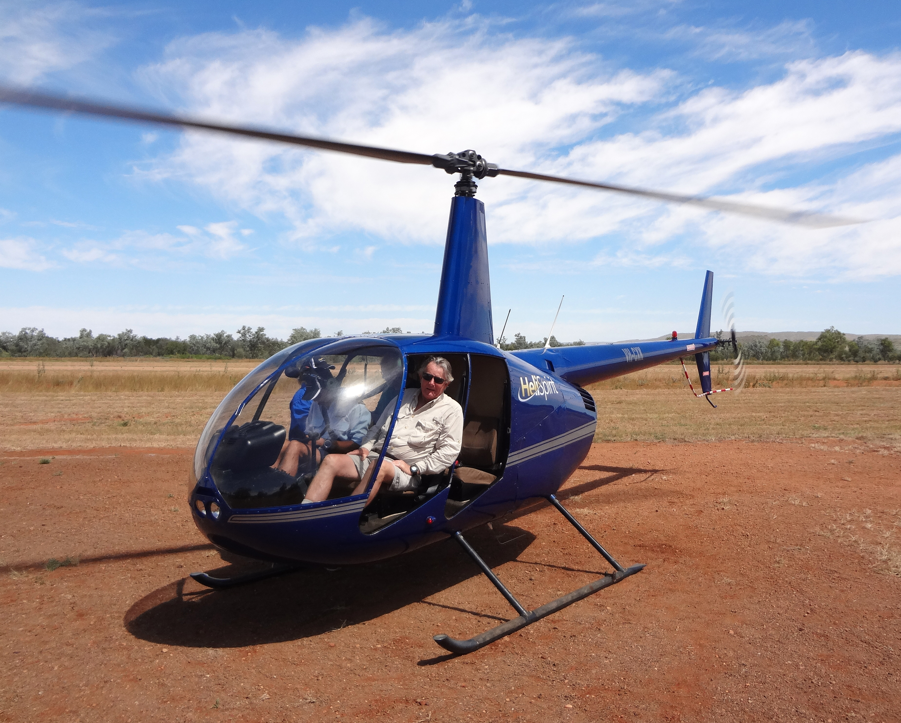
The local helicopter tours are based at the Bellburn Airstrip about 17km south of the Visitor Center at -17.53798oS 128.30581. There HeliSpirit offers a choice of three helicopter tours of the Bungle Bungles as shown in the attached map. The choices are a 18min, a 30min and a 42min version.
| 
| |
|---|---|---|
| Helicopter route (green, 30min tour) | Take off! |
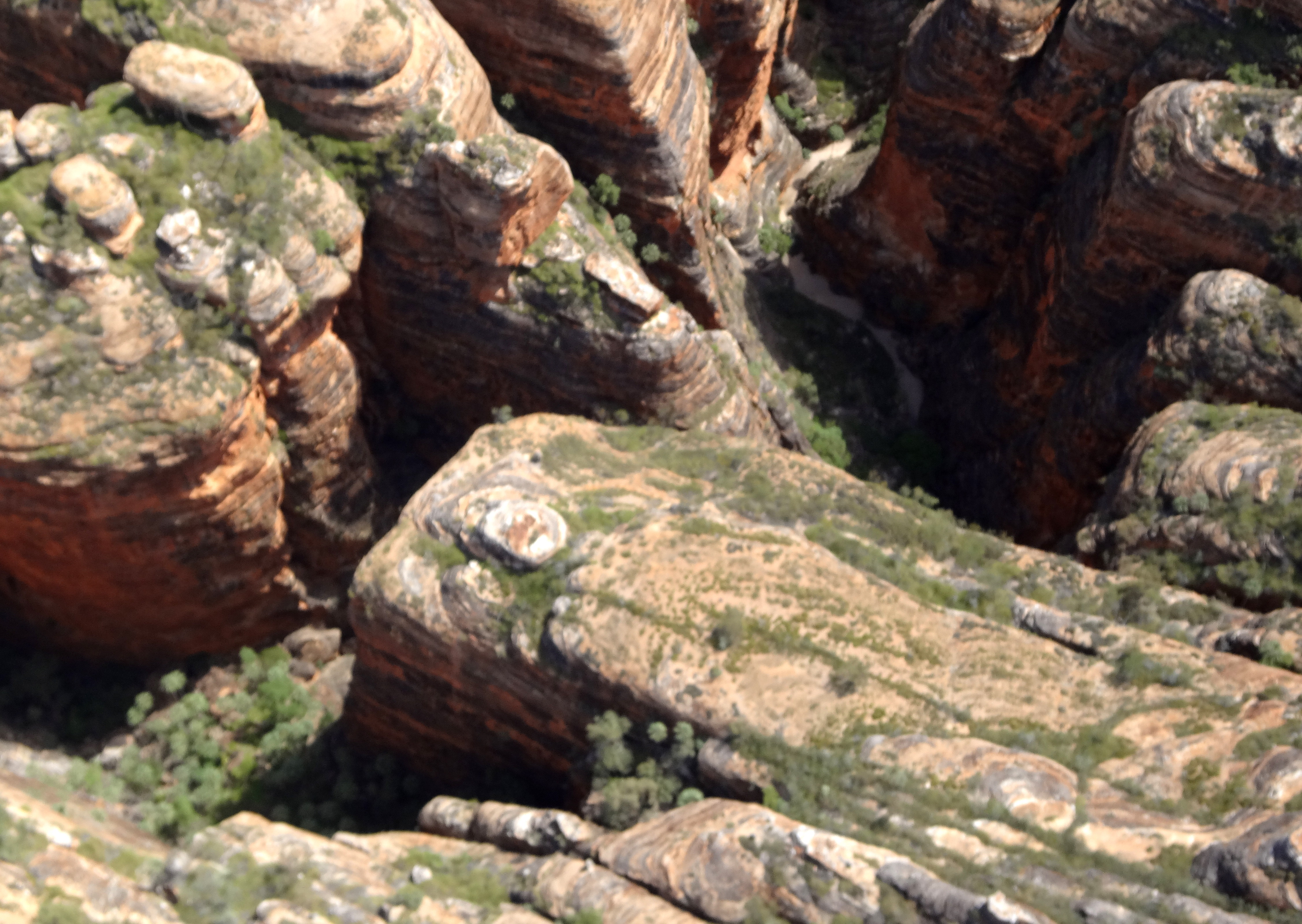
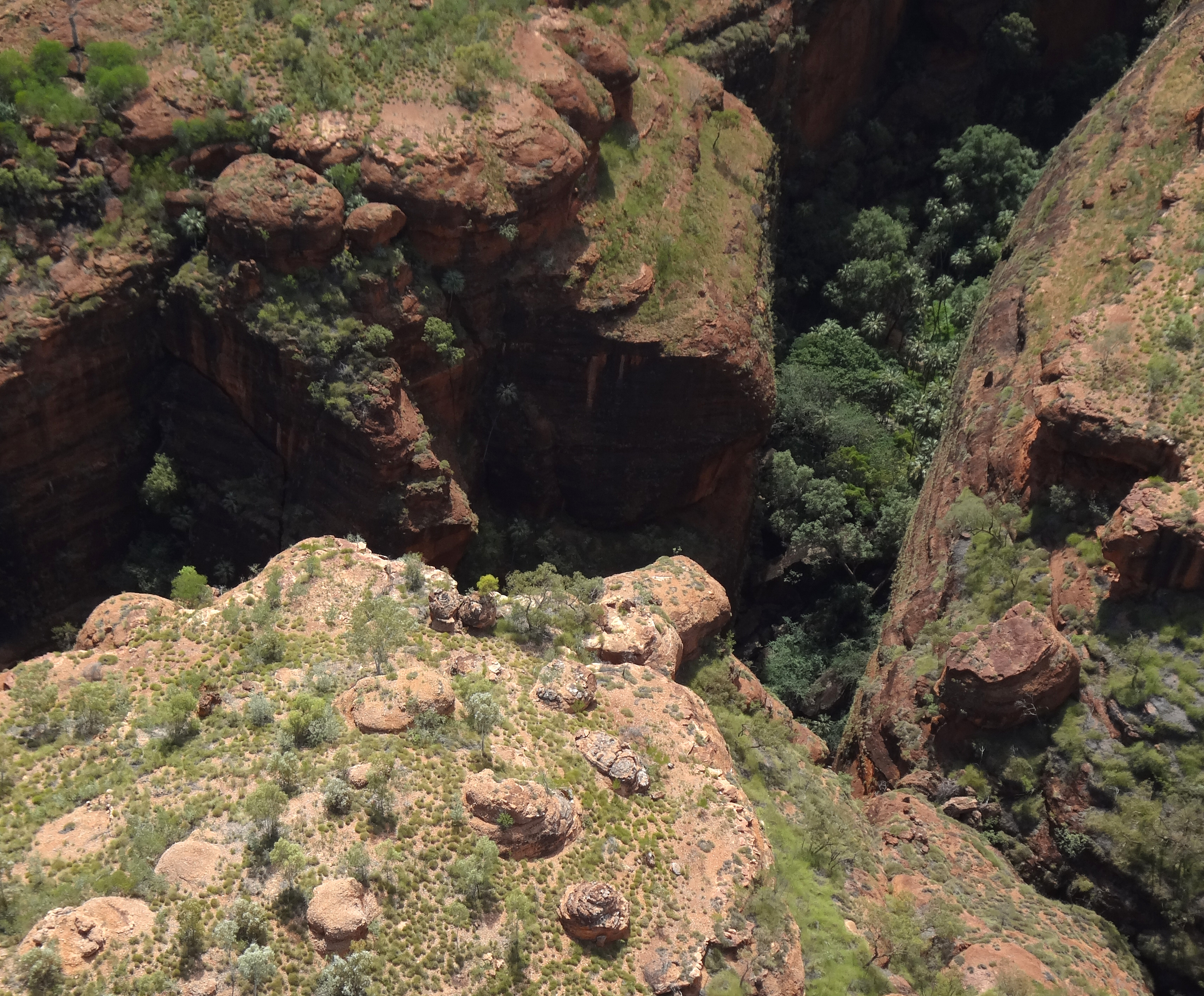
We selected the 30min tour which gave a comprehensive overview of the main features of the Bungle Bungles. Not only do you gain a different perspective on the dome structures but you also get an overview of the deep gorges eroded into the Purnululu plateau, many of which are inaccessible to the hiker because they are private to the local aboriginals who secrete the remains of their dead in many of the crevices and caves in the gorges. The doors of the helicopters have been removed to enhance the view but this means the flights are not for the faint of heart. However, the views are truly spectacular and the pilot provides a running commentary during the flight.
| 
| |||
|---|---|---|---|---|
| Bungle Bungles from the air | ||||
| 
| |
|---|---|---|
| Bungle Bungles from the air | ||
Last updated 3/21/16.
Christopher E. Brennen