ADVENTURE HIKES AND CANYONEERING
IN THE SOUTHWEST
© Christopher Earls Brennen

|
|---|

|
Hike E5. Yankee Doodle Canyon
- Hiking time: 3.5 hours
- Estimated hiking distance: Less than a mile
- Elevation gain: 240ft
- USGS Topo Map: Harrisburg Junction, UT
- Difficulties: Two rappels of 25ft and 70ft; many moderate downclimbs up to 10ft
- Special equipment: A 150ft rope; harnesses and rappeling gear.
- Permit: None required.
-
ACA Rating: 3A II

Characteristics
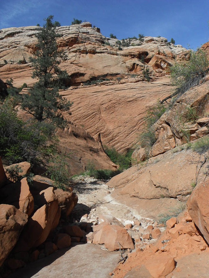
The slick rock country of southwestern Utah is filled with places where runoff has cut narrow slot canyons through the rock and left an adventureland for the canyoneer. Though best known for the spectacular canyons of Zion National Park, there are many thousands of less well known slots that provide for adventure beyond the crowds of Zion. Yankee Doodle canyon (more precisely, Yankee Doodle Hollow Creek canyon) is one such place. Located in the Dixie National Forest, up on Cedar Ridge just west of the town of Leeds on Interstate 15, Yankee Doodle is within easy reach of Zion and makes for a short interesting canyon descent with a couple of rappels and a number of downclimbs. This is a good canyon for beginning canyoneers.
Trailhead
To reach the trailhead take the Leeds exit from Interstate 15, 14mi north of St.George, Utah. Coming from the south that exit ramp transitions into State Route 228N which you follow until you come to the intersection with Silver Reef Road. Turn right and follow Silver Reef Road westwards as it winds past houses and up toward the range of hills to the northwest. At the western border of Leeds you cross a bridge over Leeds Creek and the pavement turns from asphalt to a graded dirt road. Drive for 7.8mi along that dirt road as it climbs up and over a ridge and down the other side. As you start the climb up to the ridgetop there is one fork 1.7mi from the bridge where you fork left following the road labelled OS1 (OS2 goes right). At the bottom on the other side of the ridge you pass by a deep canyon on your left.
At one point you will pass through a ranch with fencing along both sides of the road and a copse of shady trees. Shortly thereafter the road runs by another large canyon on your left. The parking for Yankee Doodle is a turnout on the right (37o14.244'N 113o27.153'W) just about 100yds down from a slight rise and 7.8mi from the Leeds Creek bridge at an elevation of 4320ft.
Hike
From the parking turnout at 37o14.244'N 113o27.153'W and an elevation of 4320ft walk about 20yds further along the road looking for a faint trail on the left which leads after about 80yds to a small wash. Turn left and follow the wash just a few yards to the first drop into Yankee Doodle canyon at 37o14.198'N 113o27.185'W. The abrupt drop is about 25ft down a narrow slot to a sandy bottom for which there are two alternative rappel anchors, webbing wraps around boulders just upstream of the lip of the drop and around a tree to the right of the slot.
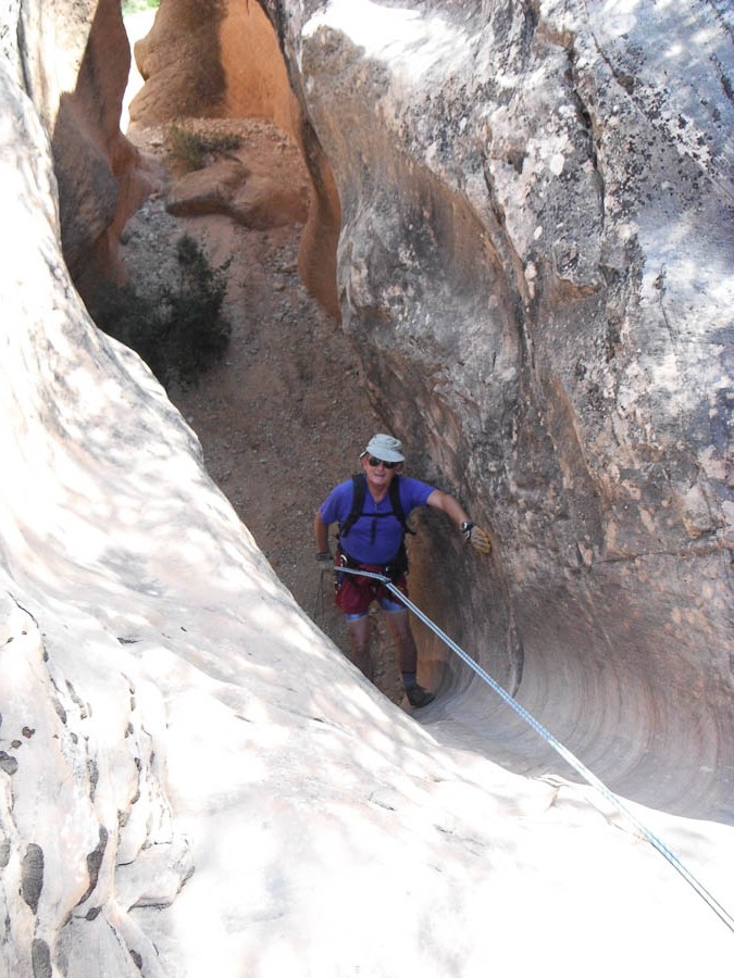
|
|---|
| First rappel (Photo by Felicia Bicknell) |
That first rappel is almost immediately followed by a 8ft downslide to the top of the main rappel in Yankee Doodle Canyon, a 70ft descent from bolts in the left wall. The entry around a boulder is somewhat awkward but is rewarded by a spectacular descent down a beautiful fluted chasm with great convoluted walls on the right side. Just beyond this 70ft rappel there are three moderately challenging downclimbs in a narrow canyon which need careful chimneying technique; the third one proceeds around a boulder and ends with a knee-deep pool. You should reach this point about 1hr 20min from the start.
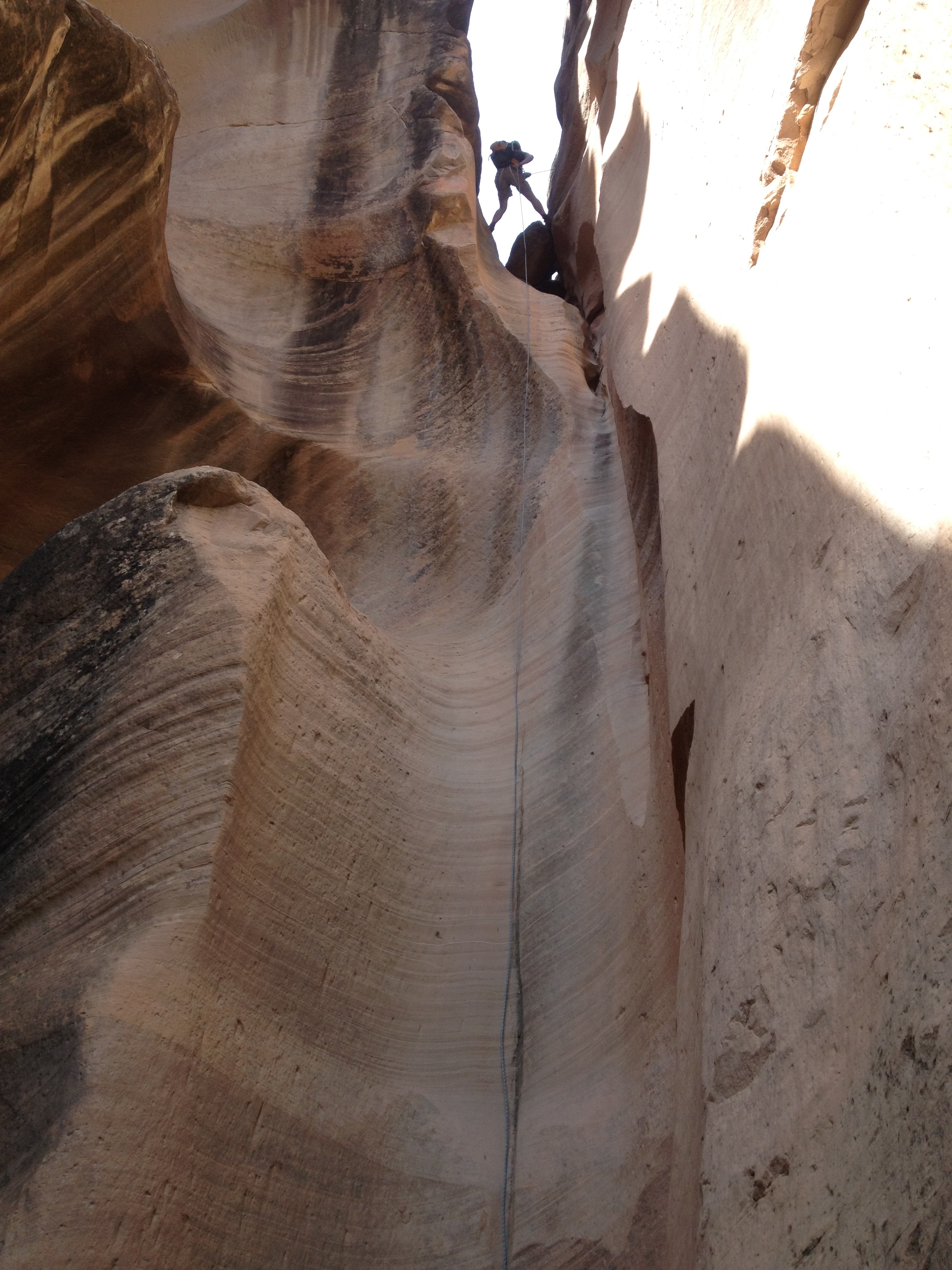 | 
| |
|---|---|---|
| Beginning the big rappel | Yankee Doodle narrows |
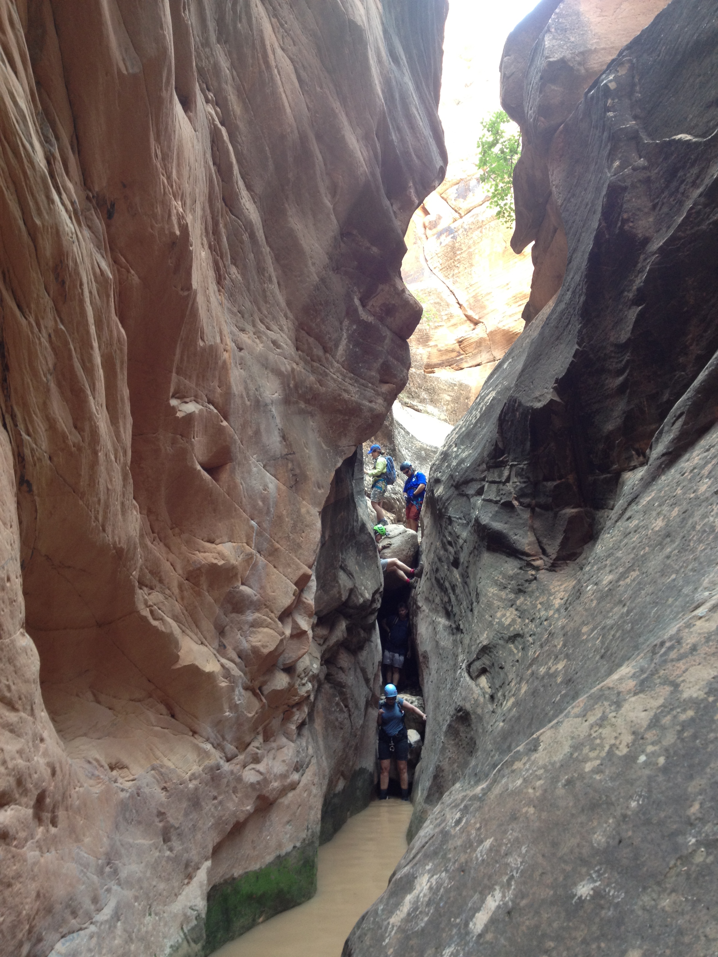
The canyon continues in a narrow slot with 5 or 6 more downclimbs of up to about 10ft in height with some pools about knee deep before the canyon finally begins to open up. About 2.5hrs from the start, you will arrive at the climb-out point which is just past a lone pine tree on the left side of the canyon bottom and a short distance upstream of where the canyon turns right. This point is less than 0.5mi from the start at 37o14.123'N 113o26.902'W and an elevation of 4080ft. You should also be able to spot the Moki steps about 35ft up the left wall of the canyon.
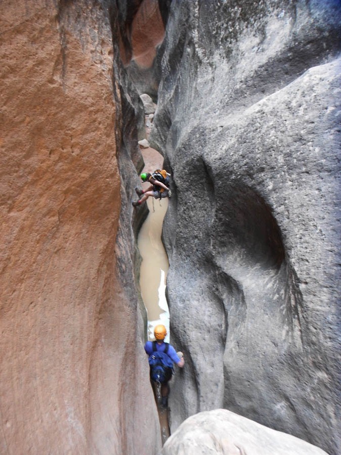 | 
| |
|---|---|---|
| Yankee Doodle narrows | Climb out past tree on left | |
(Photos by Felicia Bicknell) | ||
Start the ascent out of the canyon by climbing up about 40ft beside low outcropping on your left that
has lots of convenient hand holds. This accesses a small ledge with some bushes. Proceed to the right to the
bottom of a series of Moki steps up an inclined slab with some exposure but also several shallow horizontal
outcroppings that provide hand and foots holds. The Moki step slab climb is only about 15ft up to a
broken recessed ledge but some may need a hand rope for security so the best climber could go first to
provide that belay. The climb proceeds up about 20ft to the right over fractured rock to a place where
you need to veer up and to the left of what looks like the best route (but cliffs out). There is a awkward
8ft friction climb up a slab to some small ledges leading right to the safety of a trail in the
wooded gully. Follow that trail up to the top of the canyon wall. There a broad trail leads just a few yards
back to the road. Turn left and hike about 250yds down the road to the car.
You should reach the car at 37o14.244'N 113o27.153'W and an elevation of
4320ft about 3hrs 20min after starting out.
Last updated 10/20/12.
Christopher E. Brennen