ADVENTURE HIKES AND CANYONEERING
IN THE SOUTHWEST
© Christopher Earls Brennen

|
|---|

|
Hike D3. Orderville Canyon
- Hiking time: 7 hours
- Estimated hiking distance: 12.5 miles
- Elevation gain: None
- USGS Topo Maps: Clear Creek Mountain and Temple of Sinawava or Zion National Park Topographical Map
- Difficulties: Two short rappels, several wet cascade descents, two pools to swim, hiking in the river
- Special equipment: 60ft rope or webbing and rapelling gear, dry bag, a stout hiking staff
- Permit: Obtain permit from Backcountry Desk in Zion National Park Visitor Center.
-
ACA Rating: 3B III

Characteristics
Like, its larger sister, the North Fork of the Virgin River, Orderville Gulch begins high on the 7000-8000ft Markagunt Plateau just outside Zion National Park in southwestern Utah. As it flows west it drops into a narrow slot canyon cut up to 1000ft deep into the Markagunt and creates Orderville Canyon, one of the spectacular canyons of Zion NP. Toward the end the slot is filled with water in a number of places and these require wading in chest-deep water and, in one place, a short swim. Downstream, it joins the North Fork of the Virgin in the middle of the Park just at the lower end of the famed Zion Narrows, providing a taste of what it is like to hike those Narrows.
Trailhead
This hike requires a long 4WD vehicle shuttle. Deposit one vehicle in the parking lot at the Visitor's Center in Zion National Park (37o12.02'N 112o59.24'W). Then, in the other vehicle(s), drive east out of Zion National Park on Highway 9. About 2.3mi past the entrance station, turn left on a good paved road at a point just beyond the top of a small rise. There is a sign indicating the North Fork. About 5mi from the turnoff, the asphalt ends and you continue on a dirt road that is fairly good when dry. It may, however, be impassable when wet. About 11.5mi from the turn-off, the dirt road crosses Orderville Gulch, after descending alongside that distinctive feature. Turn around here and go back 0.8mi to where a narrow dirt road proceeds off to the west (37o20.23'N 112o49.84'W) at the crest of a small hill. About 100yds down this road you come to a broad corral surrounded by a wire fence (37o20.09'N 112o50.07'W). This is where you should park if you are driving a two-wheel drive vehicle. A gate leads to a rough and steep dirt/rock road that descends to the bottom of Orderville Gulch. This is the route whether you are on foot or in a four wheel drive vehicle. It may be passable in a four-wheel drive vehicle though the road is easier to descend than ascend. About 0.7mi from the corral you reach the flat bottom of the gulch; here the road crosses Orderville Creek and follows the right bank on a flat bench for perhaps 0.5mi. It then crosses the stream again and proceeds for a similar distance on the left side. The dirt road ends in a broad, flat clearing (37o19.96'N 112o51.70'W) in the low brush where, if you can get this far, you should park.
Hike
From the clearing (37o19.96'N 112o51.70'W and elevation 5700ft), a rough trail descends to the creek and you should follow the almost dry streambed for about 0.5mi as it winds its way across a broad, flat bottom. About 20min from the start at an elevation of 5360ft, there is a dramatic change in the landscape when you arrive at the sudden and steep 120ft dryfall (37o19.52'N 112o52.23'W) that marks the beginning of Orderville Canyon. You may choose to follow the course of the streambed and rappel down the dryfall in two or more stages. Or you may choose to rappel down an even steeper chimney about 60ft to the left of the main streambed. But this is a long hike and the much simpler and faster route is to backtrack and find the use-trail about 50yds to the left of the top of the dryfall. We came upon this automatically by following the use-trail on the left bench. (An unusual conifer stands beside the trail just where it reaches the lip.) The use-trail then descends a steep dirt slope to the canyon bottom that is narrow for a brief stretch but then broadens to provide fast and easy going in a rapidly deepening canyon. This is a lovely walk on a bright summer morning and the colors of the trees, rocks and sky are heightened by the crystal air of this high plateau country. About 0.6mi downstream of the dryfall (and 40min from the start) you will encounter Birch Hollow, a sculpted rock-cavity on the left with a spectacular dryfall.
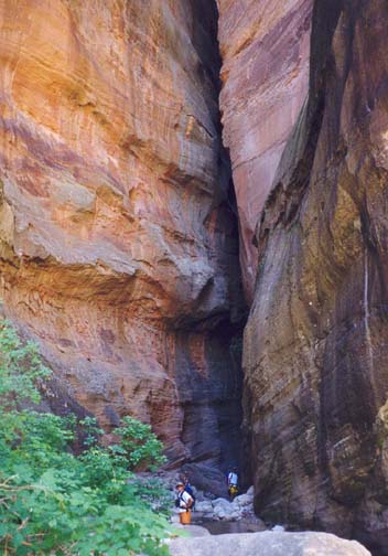
 | 
| |
|---|---|---|
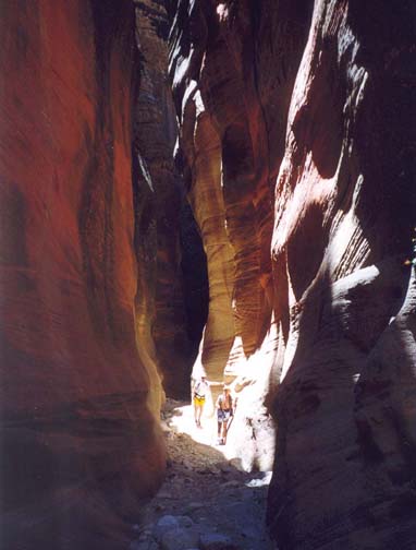
| Orderville Narrows | Boulder obstacle |
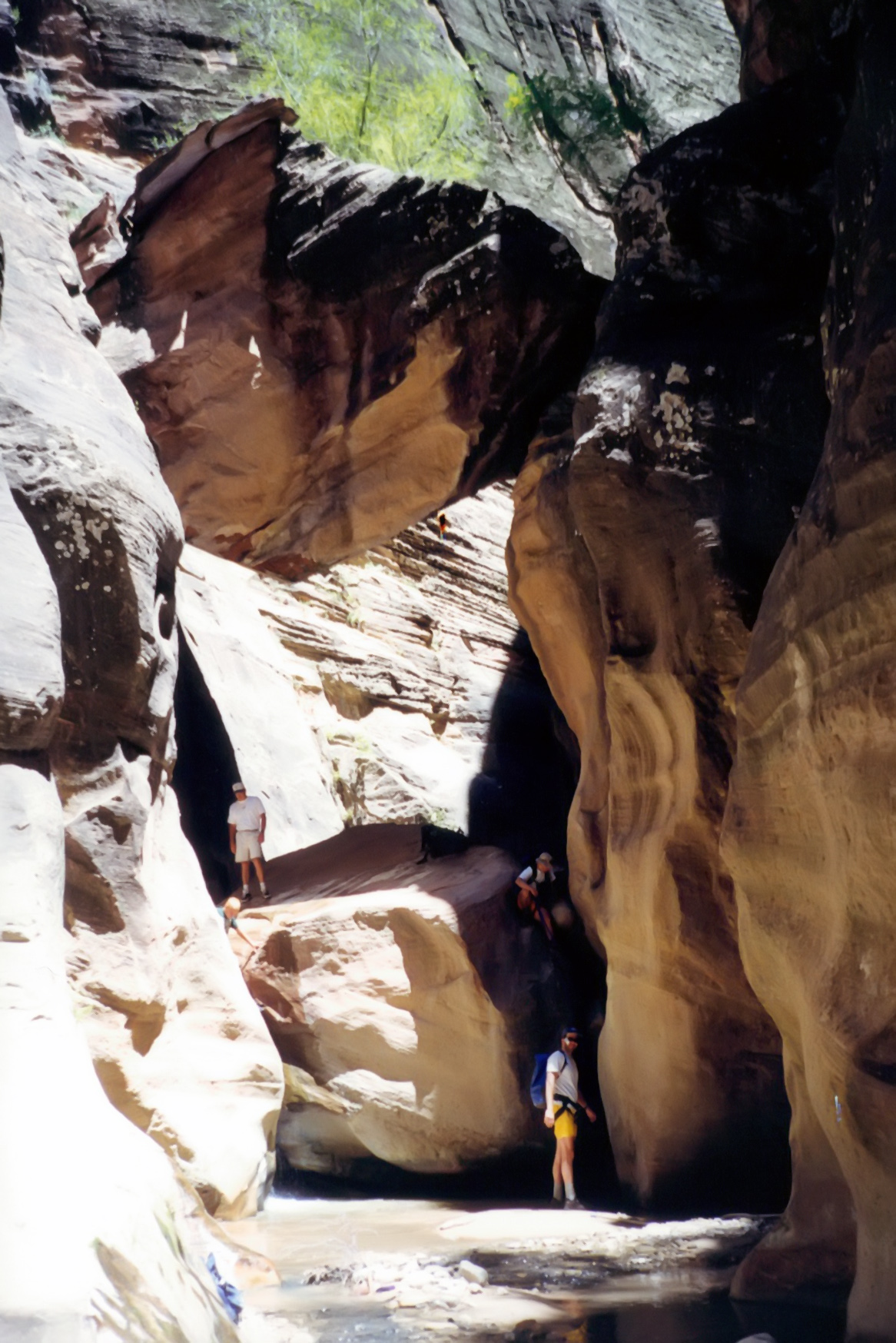
The next 2.2mi continue to provide easy going along a gentle grade. The canyon walls steepen and, in places, begin to close in. Then at one particular narrows you encounter the first substantial obstacle, a large, canyon-blocking boulder (37o19.01'N 112o54.08'W) with steep 15ft drop on the downstream side. It is wise to use rope or webbing to rappel or downclimb this obstacle. The narrow slot on the right can be chimneyed fairly safely given boots with reasonable traction but some protection or belay would be wise. When we came this way the bottom was covered in a layer of very gooey mud; we also delayed about 40 additional minutes in order to help a group of eight young people descend safely. Undelayed it should take about 3hr to get to the bottom of this boulder obstacle. Thereafter, the going remains easy for the next two miles and along this stretch we had lunch. Then, roughly 3hr 45min from the start, Bulloch Gulch enters on the right and brings with it enough water so that, downstream from the confluence, a stream runs in the canyon the rest of the way. Just downstream of Bulloch Gulch, you enter a spectacular narrows crossed by fractures in several places. Then, a mile below Bulloch Gulch, a second fantastic obstacle presents itself. This consists of two huge chockstones, one of which blocks the canyon and requires another downclimb or short rappel. The other huge chockstone is lodged directly overhead forming a massive arch. There is even a tree growing on top of this upper chockstone. We used webbing to rappel about 12ft down the slot on the left though the falls on the right could also be downclimbed using the logs wedged in its face.
 | 
| |
|---|---|---|
| Orderville Narrows | Orderville Narrows |
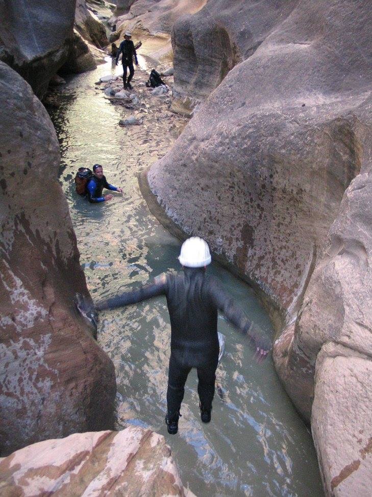
At this stage, you enter even more spectacular narrows. The going is also harder between here and the Virgin River and you will need to negotiate a series of small waterfalls and pools some of which require swimming. Here we began to encounter groups of young people who had come up from below to enjoy this water wonderland. Just a short distance downstream of the huge chockstones the canyon narrows further and you must chimney down a small waterfall to the right of a large boulder. Then a series of pools and small waterfalls require chest deep wading and even some swimming. Another short distance downstream, you arrive at the top of an 8ft waterfall dropping into a deep pool. We jumped into this pool since others were present to confirm the depth; if this had not been the case we would have had to arrange a belay or rappel. A similar obstacle occurs a short distance further downstream but here it is easier to slide down from the shelf on the left into the end of the pool.
 | 
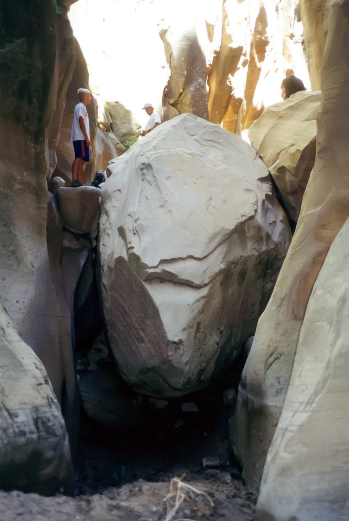
| |
|---|---|---|
| Double boulder | Near end of Orderville |
 | 
| |
|---|---|---|
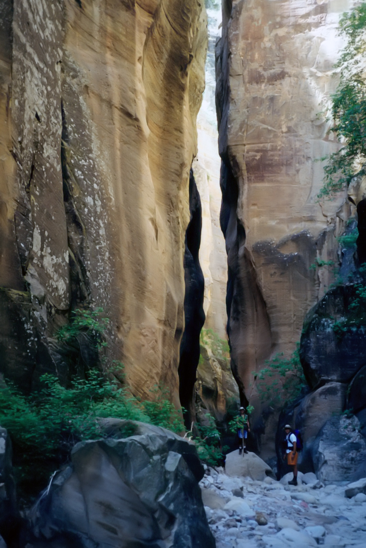
| Pool near the Narrows junction | Zion narrows at junction |
A series of more
modest obstacles in the form of pools and falls are encountered before a last stretch of
narrow, deep and
barren canyon. This leads directly to the junction
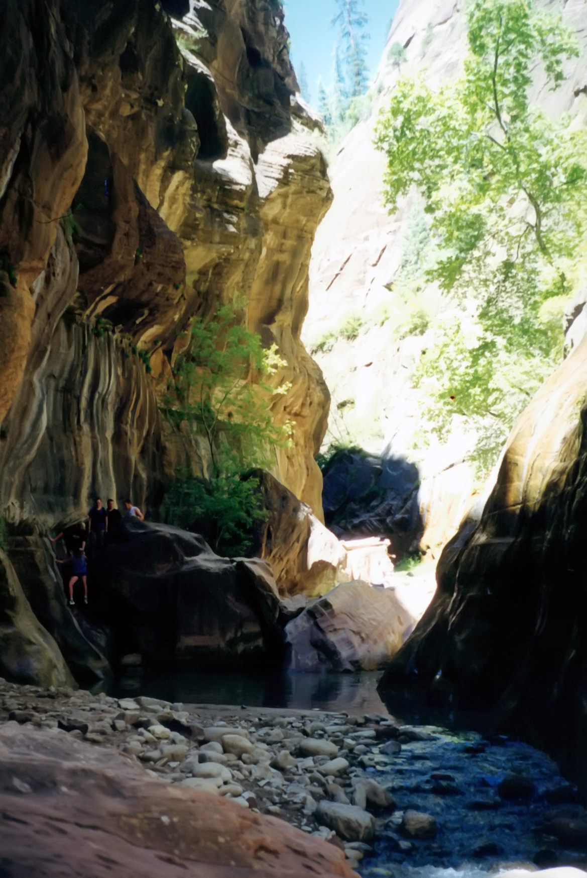
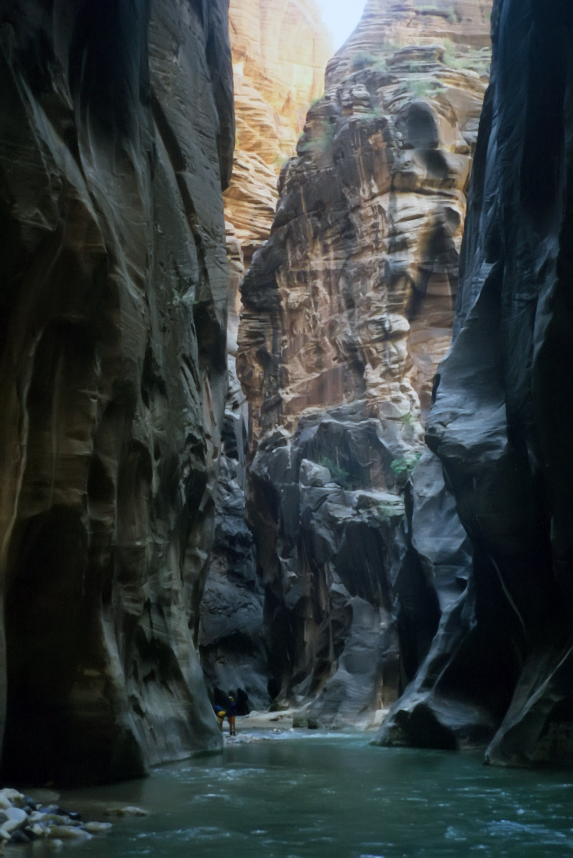
at 37o18.49'N 112o56.81'W and elevation
4568ft (and 5hr 30min from the start) with the awesome
Zion Narrows where the North Fork of the Virgin River flows through
an incredible 1000ft slot canyon whose bottom is filled with Virgin
River cascade. Stop and savour this awe-inspiring cathedral of a place.
Though you will only travel the last 100yds of this great gorge, it
provides a taste of the Zion Narrows adventure described elsewhere in
this journal. The exit of the true Zion Narrows is just about 100yds
downstream of the Orderville Canyon confluence. There
the canyon broadens
and pretty wooded benches appear again. Sunlight penetrates
and it is a beautiful hike downstream to the the point where
the concrete Riverside Walk begins. By this stage there are usually
crowds of people enjoying the canyon and the adventure of a short
hike up into this wilderness. The terminus of the concrete and asphalt
Riverside Walk (37o17.80'N 112o56.90'W)
is usually crowded with people peering up into the
drama of Zion Narrows. From there it is but a 20min walk to the
parking lot at the Temple of Sinawava
(37o17.11'N 112o56.86'W and
elevation 4411ft) and the
conclusion of this marvellous adventure about 7hr after setting out
from the mesa now high above and far behind. Catch the free shuttle at
the Temple of Sinawava for the ride back to the Visitor's Center.
Last updated 9/9/99.
Christopher E. Brennen