ADVENTURE HIKES AND CANYONEERING
IN THE SOUTHWEST
© Christopher Earls Brennen

|
|---|

|
Hike H1. Mount Hoffman
- Hiking time: 3.5 hours
- Estimated hiking distance: 5.6 miles
- Elevation gain: 1912 feet
- Topo Map: Yosemite National Park Topographical Map
- Difficulties: Some scrambling near the summit
- Special equipment: None
Characteristics
It was Abraham Lincoln who set a marvellous precedent for the world when he signed the bill in 1864 establishing Yosemite as the nation's first state park; twenty six years later it became a National Park. And yet the magnificence was revered before the white man ever set foot in this land of spectacular natural beauty. One of the most beautiful landscapes in the world is the high country in Yosemite and one of the most spectacular views in this landscape is from the 10850ft summit of Mount Hoffman.
This is the land that John Muir explored during the summer of 1869. His account entitled My First Summer in the Sierra did much to bring the beauty of these mountains to the attention of the world and his is the first recorded ascent of Mount Hoffman. Moreover, apart from some minor scrambling near the summit this is one High Sierra peak within the range and ability of the average hiker. The views open up as one proceeds through the wooded, subalpine slopes around May Lake, transition to broad wildflower meadows and then to the rocky slopes around the summit.
The peak is named after Charles Hoffmann, a member of the 1863-67 Whitney Geological Survey, who also named the lake after Lucy Mayotta Browne whom he married in 1870.
Trailhead
This hike begins at the May Lake trailhead (37o49.96'N 119o29.40'W) not far from Tenaya Lake in the High Sierras of Yosemite National Park. The paved road to the May Lake Trailhead branches off from the Tioga Pass Road (Highway 120) at 37o49.05'N 119o30.60'W and about 1.3mi west of Tenaya Lake. The Tioga Pass Road is typically open from June through October and the May Lake Trailhead road for a somewhat shorter window.
Drive west on the Tioga Pass Road from the Sunrise Lakes Trailhead at Tenaya Lake (37o49.55'N 119o28.22'W and elevation 8160ft) for 1.3mi to the turn-off right at 37o49.05'N 119o30.60'W toward the May Lakes Trailhead. Then drive north for 1.2mi to the May Lakes Trailhead (37o49.96'N 119o29.40'W at elevation 8740ft) where you should park.
Hike
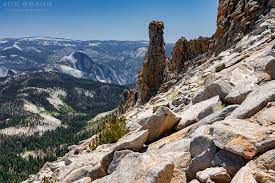
From the May Lake trailhead parking area (37o49.96'N 119o29.40'W at elevation 8740ft), follow the well-maintained and easy trail through the woods for 1.2mi to the beautiful May Lake (37o50.67'N 119o29.39'W and elevation 9270ft) and the May lake High Sierra Camp. From there contour around the southern shore of May Lake on the easily followed and popular use-trail for about 0.5mi. There the trail turns south and climbs gradually past some lovely wildflower meadows in a gently rising valley bounded on the west by the steep slopes of Mount Hoffman. About 0.7mi beyond the lake the trail turns northwest and climbs the increasingly bare slopes toward the summit. A notable landmark to the south of the trail is the rock pillar known as the Hoffman Thumb. Some scrambling brings you to the 10,850ft summit of Mount Hoffman marked by a natural cairn at 37o50.82'N 119o30.58'W. It should take about 2.0hrs to cover the 2.8mi from the trailhead to the summit.
|
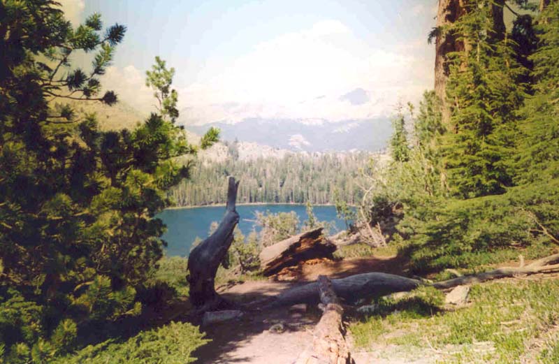
|---|
| View of May Lake from the trail to the summit |
|
|---|
| Hoffman Thumb from near the summit |
The views from the summit are spectacular in all directions. To the southeast Clouds Rest is easily recognized as is Half Dome a little further south. Moreover the views to west and north are almost as marvellous.
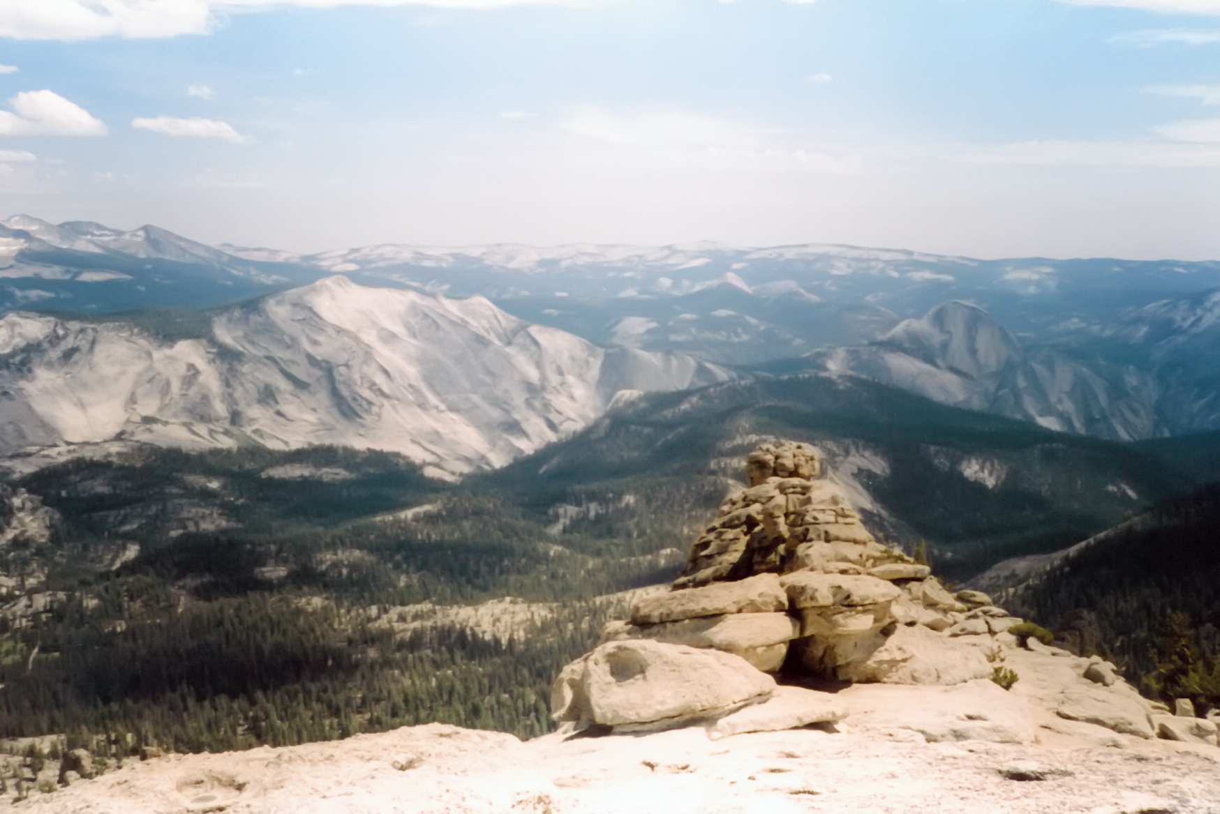 | 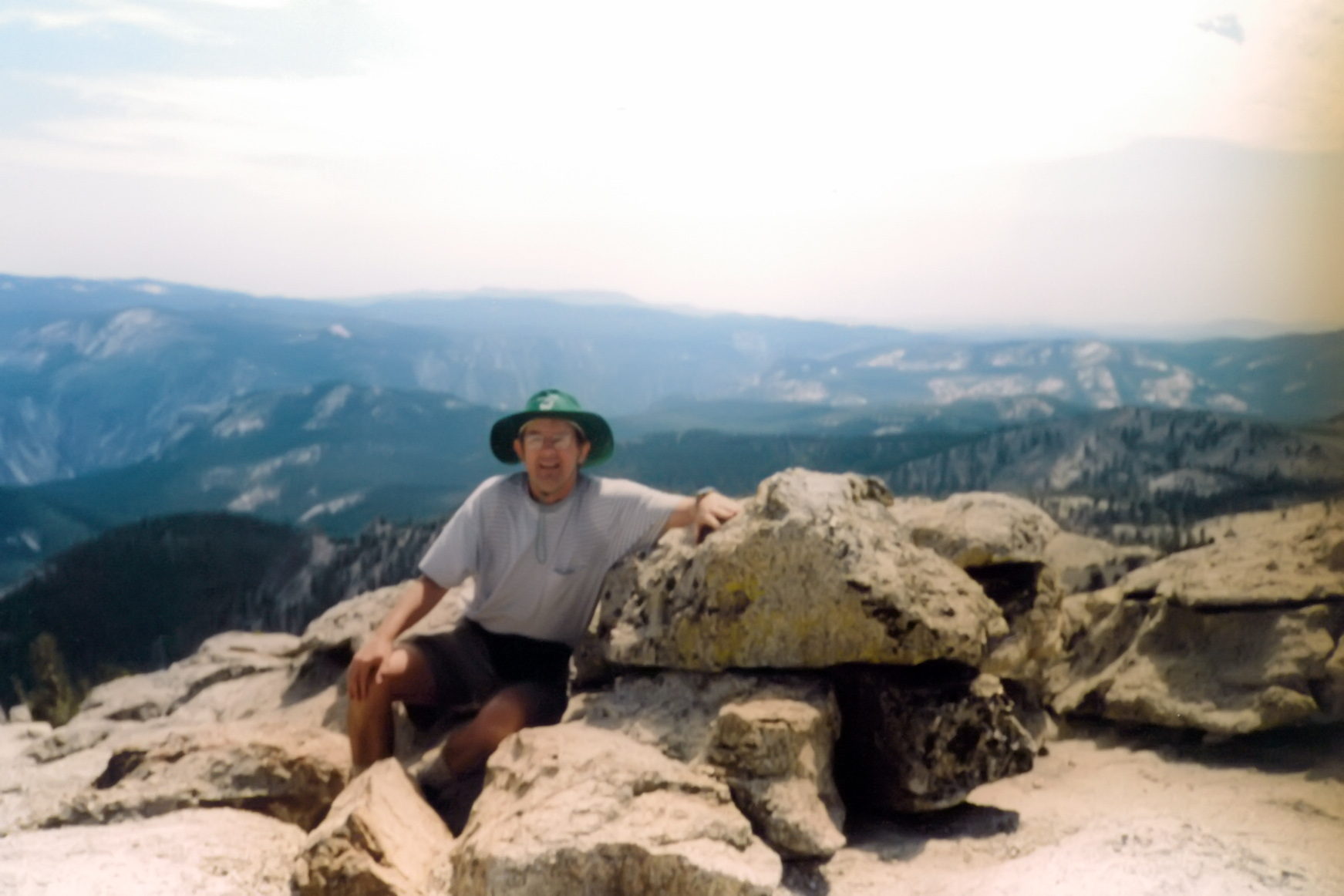
| |
|---|---|---|
| View from summit | The author on the summit |
Christopher E. Brennen