ADVENTURE HIKES AND CANYONEERING
IN THE SOUTHWEST
© Christopher Earls Brennen

|
|---|

|
Hike F1. Mount Charleston
- Hiking time: 10 hrs
- Estimated hiking distance: 13.5 miles
- Elevation gain: 4380 feet
- USGS Topo Map: Charleston Peak
- Difficulties: No water
-
Special equipment: None required
Characteristics
Mount Charleston is the highest point near Las Vegas, 11,916ft in height. It is a rugged all-day, 6.8mi climb taking you along the South Loop Trail from the verdant 4380ft elevation of Mount Charleston canyon to the barren, windswept 11916ft summit of Charleston Peak, 6.8mi from the valley floor. It is a scenically spectacular hike that culminates near the summit with the remains of a intriguing aeroplane crash.
For obvious reasons, the trail is closed during winter months.
Trailhead
This account decribes the easiest way to get to the summit of Charleston Peak, namely the route known as the Charleston Peak South Loop Trail. This begins in the Cathedral Rock Trail Head (4380ft elevation, 36.25409oN 115.64268oW) in the town of Mount Charleston and the end of route 157 in the town of Mount Charleston. There are several parking options at the Cathedral Rock Trail Head and you should chose the parking area that precludes being locked in for the night even though it is a little further down the picnic area parking area.
Hike
Follow the signs for the Cathedral Rock trail and then the Charleston Peak summit trail (or South Loop Trail). This starts off at 4380ft elevation at 36.25409oN 115.64268oW at an easy pace as it heads southwest but the grade increases rapidly and you start switchbacking up the cliff about 36.24448oN 115.64001oW and an elevation of 8517ft some 0.8mi from the start. Higher up you come to a scenic overlook at 36.24581oN 115.64255oW some 1.45mi from the start at an elevation of 9150ft. The climb continues but reaches a plateau at about 36.23685oN 115.65107oW, 2.5mi from the start at at elevation of 10702ft.
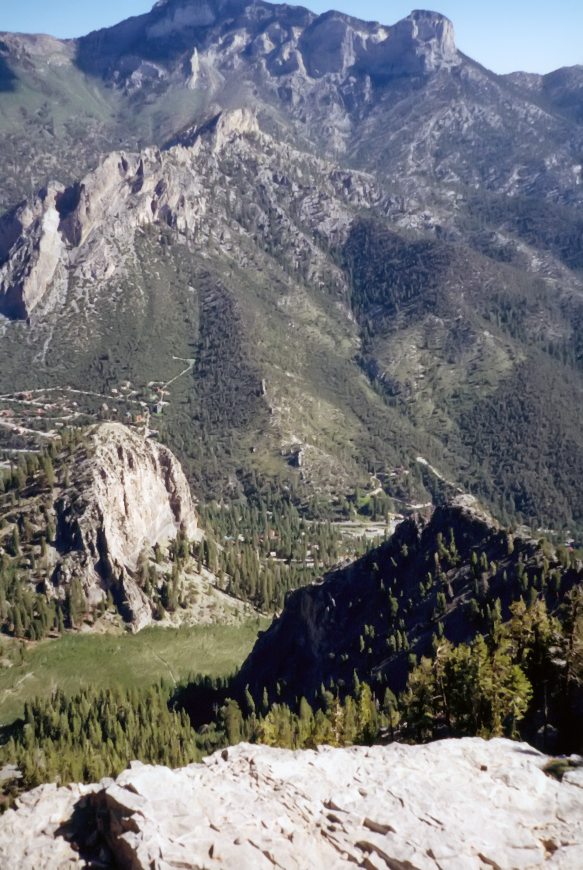
|
|---|
| Mummy Mountain and Cathedral Rock from the Scenic Overlook |
The trail then heads west and soon enters a delightful meadow. This part of the trail is referred to as The Meadows and is a favorite spot for campers. Charleston Peak comes into view several times during the ramble through the meadow. The Meadows gives way to a grove of timber as the trail heads west and the grade increases. At 36.25230oN 115.67271oW, 4.3mi from the start at an elevation of 10948ft it hugs the ridgeline for more than half a mile, offering remarkable views of Kyle Canyon, Mount Charleston Lodge, and State Route 157. Directly across the canyon is Mummy Mountain, and to the west is North Ridge Rim.
The trail turns away from the ridgeline and heads southwest before it climbs to another ridge. The trail heads northwest toward the summit and away from the false peak. About 150yds past a saddle a faint path to the south (left) travels down to Peak Springs. Due to the wind and elevation, the landscape becomes harsh. Bristlecone pines are reduced to twisted dwarfs. You're above 11,000ft at this point. Charleston Peak looks more like a ridge than a summit from this angle.
Just below the summit and off to the right about 36.26935oN 115.69474oW, 6.5mi from the start at at elevation of 11663ft you encounter the wreckage of a USAF plane that crashed on November 17, 1955. Fourteen men lost their lives when the Douglas C-54M Skymaster (#44-9068) slammed into the mountain during a blizzard and strong crosswind. The plane was carrying scientific and technical personnel from the Lockheed Skunk Works in Burbank, California to Groom Lake, Nevada where they were working on the U-2 spy plane. Because of the secrecy, the crew were never in contact with air traffic control. The error in the position of the aircraft relative to the Spring Mountain range and the vision obstruction by the clouds resulted in the plane crashing just 50ft below the crest of the ridge leading to the Charleston Peak summit.
The last section of the hike to the peak is a steep 20% grade. Just before the peak the trail forks. Both trails go to the peak; however, the main trail is less steep. The wind can be harsh above the treeline.
The summit of Charleston Peak
(11916ft at 36.27166oN 115.69553oW and 6.74mi from the start) is bare and rocky. There is a small radio repeater, a survey marker or two and a summit log. An excavated pit about 4ft deep and 10ft across allows some shelter from the wind.
The 360-degree view of southern Nevada, eastern California, and southern Utah is spectacular. An ammunition box contains a sign-in book. You can return the way you came up or make a loop by hiking down the North Loop Trail to Trail Canyon.
Christopher E. Brennen