THE FAR SIDE OF THE SKY
© Christopher Earls Brennen
SKELLIG MICHAEL
"... they landed me on the most fantastic and impossible rock in the world: Skellig Michael, or the Great Skellig, where in south west gales the spray knocks stones out of the lighthouse keeper's house, 160 feet above calm sea level."
From a letter by George Bernard Shaw to his friend Jackson, Sep.10, 1918.
Around the world there are a few special structures that represent the pinnacle of human endeavor and achievement. Some, like the Taj Mahal, are unique for their elegance. Some, like the Great Pyramids, the Great Wall or Stonehenge, are wondrous for their engineering. Others, like Macchu Picchu, were constructed in spectacular natural settings. And then there are a few that cause us to truly marvel at the limits of the human spirit. This story is about one such place.
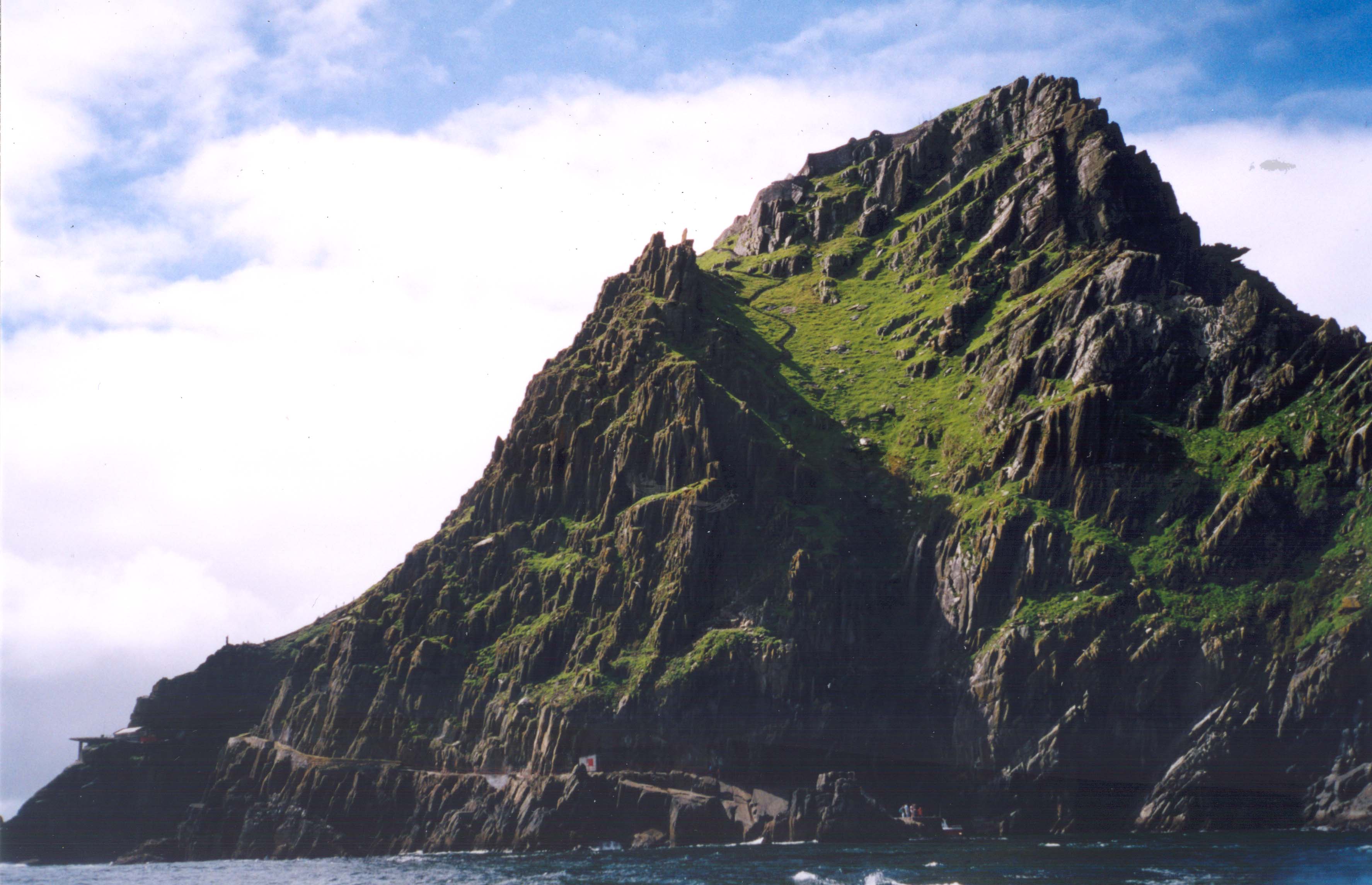
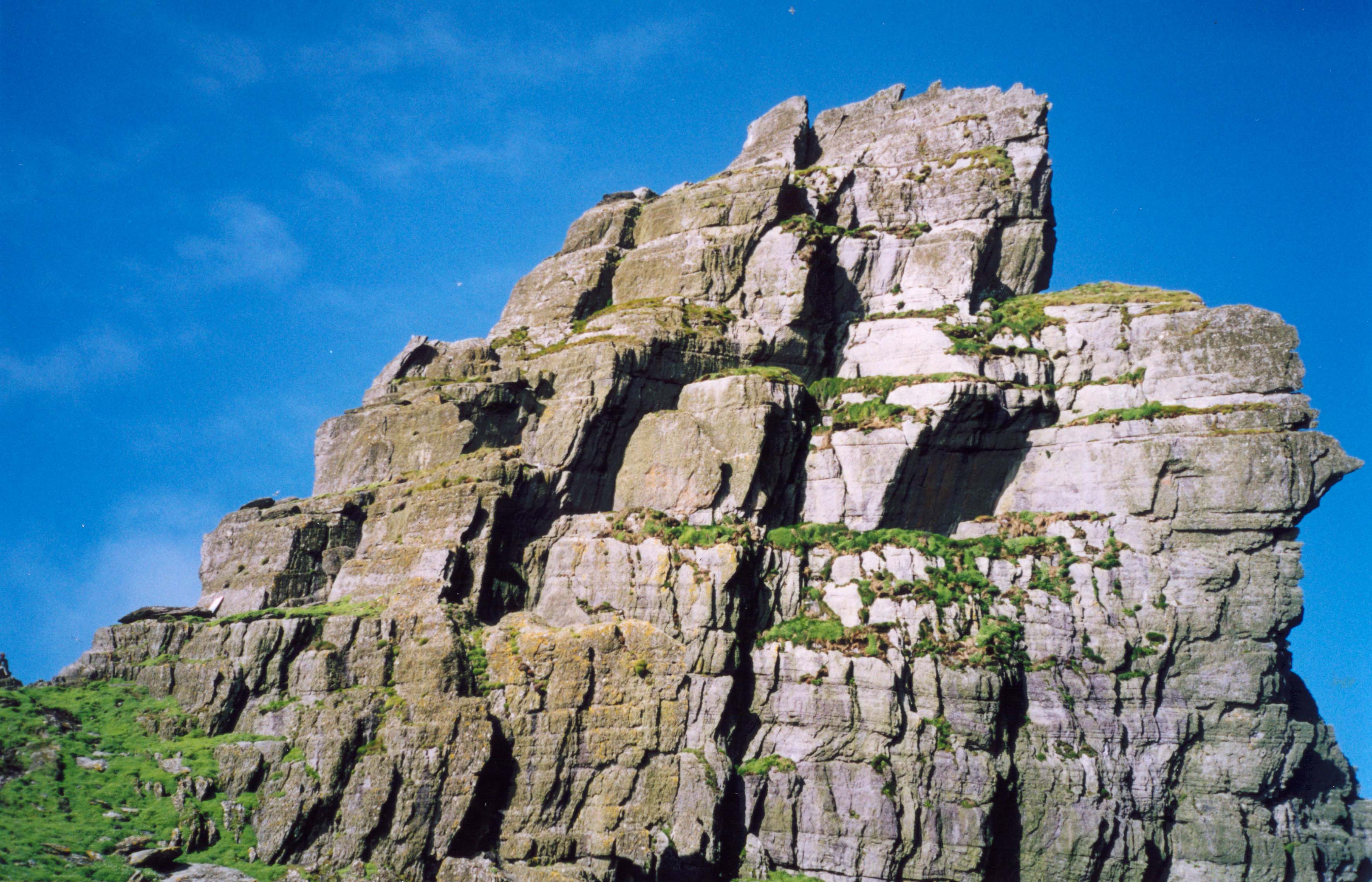
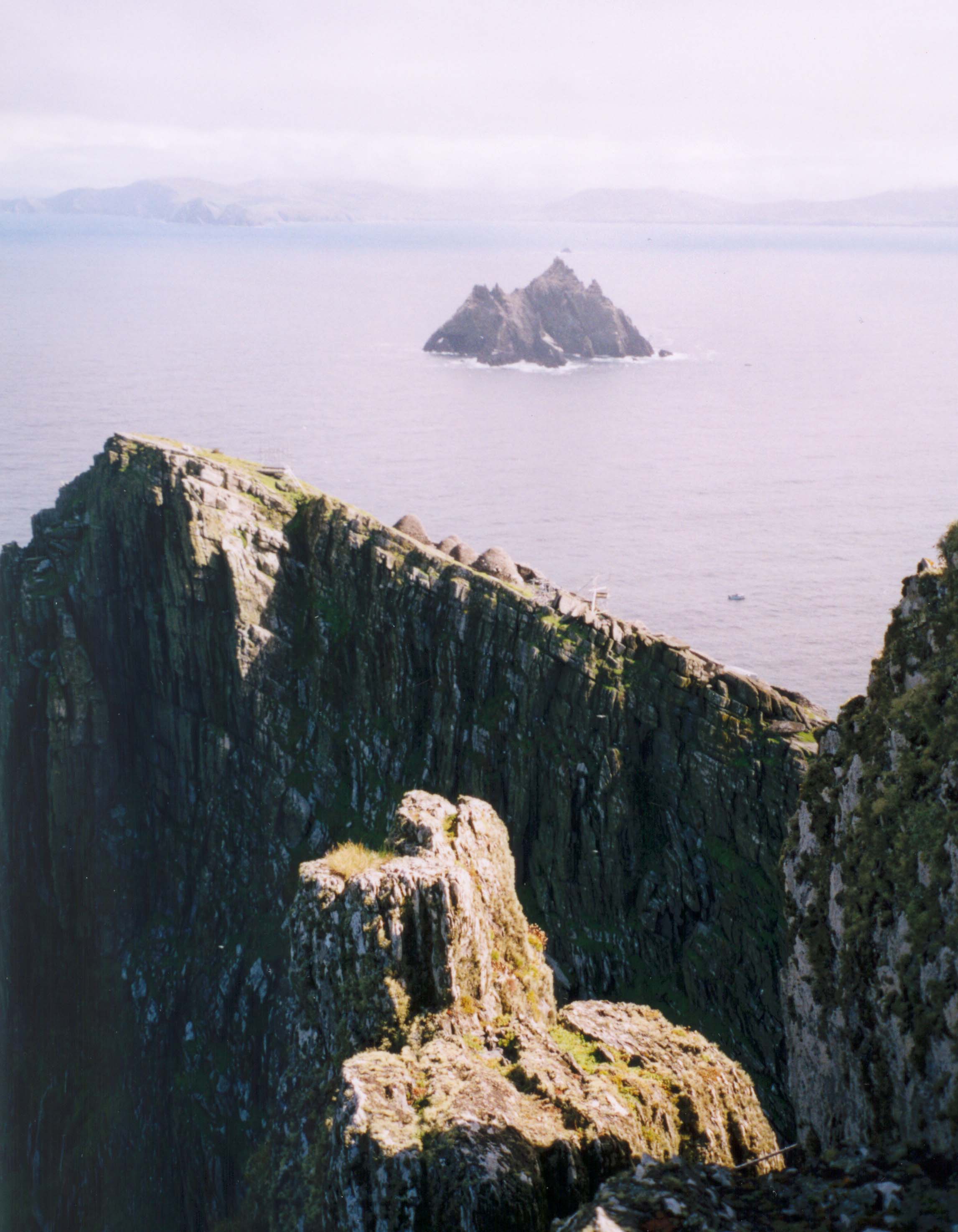
Out in the raw north Atlantic, an eight mile voyage from the rugged southwest coast of Ireland, there is a precipitous pinnacle of rock that rises some 700ft above the waves. This sea-girthed mountain top, storm-shredded and wave-smashed, surrounded on all sides by dark cliffs rising sheer out of the ocean, is known as Skellig Michael. The apex of this island consists of two peaks: the lower, 607ft peak is rounded and has some grass-covered spaces. The higher 715ft South Peak is an almost vertical crag with a sharp rock summit. In between the peaks is a feature known as Christ's Saddle (elevation 400ft). Needless to say the area available for human exploitation is very small and very high above the ocean. One would expect that the rock could only be home to a few fearless seabirds. And yet sometime in the sixth century, when the rest of Europe was deep in the Dark Ages, a small group of ascetic monks sailed from the Irish mainland in fragile currachs (boats made of animal skins and tar) and made perilous landfall on Skellig Michael. Some believe they were fleeing from the rampaging savagery of their fellow men. Others think they were seeking the ultimate austerity, believing that brought them closer to God.
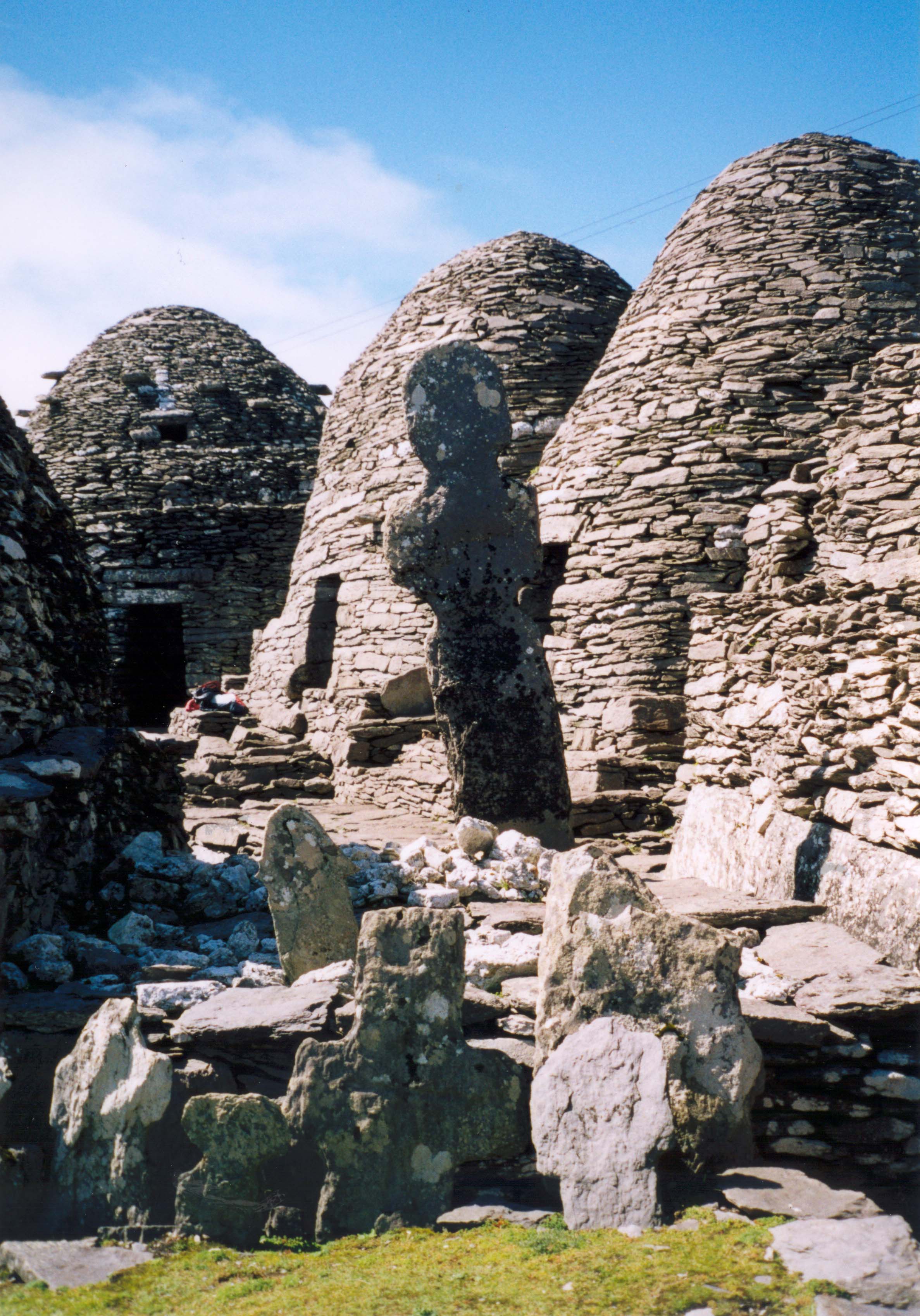
Whatever drove them they were determined to make permanent settlement in this fierce place. They managed to climb the cliffs to the saddle and thence to the flat spaces on the lower summit. There, over the decades, they constructed a tiny monastery from the only material available, namely the rock itself. Due to their stone construction and their isolation, the remains of this monastery are remarkably well preserved and consist of six small beehive cells, round on the outside and rectangular within. Two places of worship were also built; one was later improved and dedicated to St. Michael so that, thereafter, the islet became known as Skellig Michael.
The monastery managed to survive for some four centuries, living on rainwater, seabirds, fish and the little oats and vegetables they could grow on the tiny plots of cleared land. They also needed supplies from the mainland. But, even here in this remote place they were not able to completely escape the marauders; the Vikings sacked the monastery in the ninth century and a number of times thereafter. Perhaps that is why the monks built a tiny retreat atop the highest place on the island, the 715ft South Peak. The climbing route to this precarious perch is daunting and much more easily defended than the monastery on the lower summit. Indeed, there is one spot along the route known as the Needle's Eye where a single man could defend against an army. Of course, it is also possible that this aerie was developed as the ultimate in devotional austerity.
 | 
| |
|---|---|---|
| Portmagee | Docked in Blind Man's Cove |
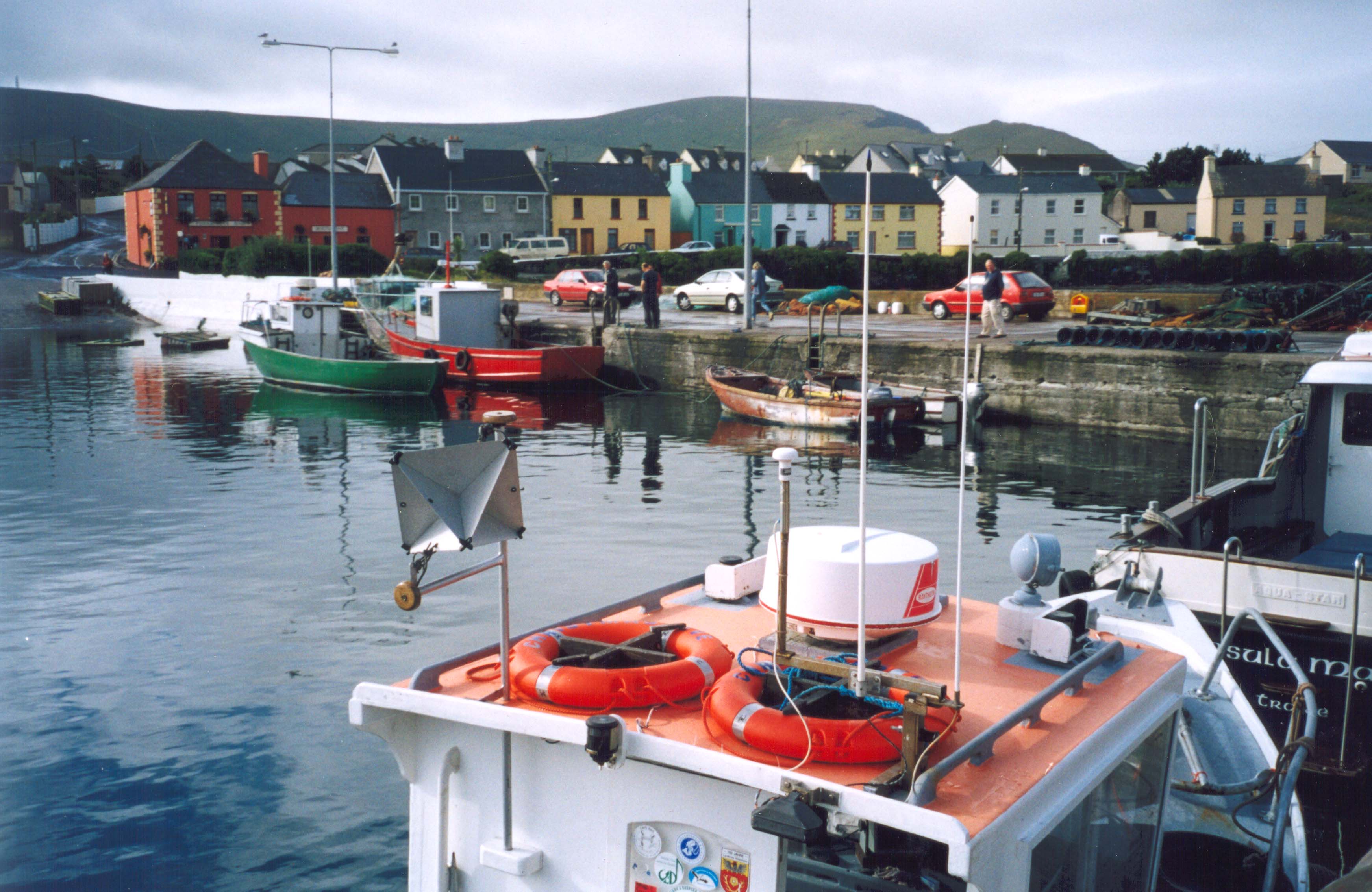
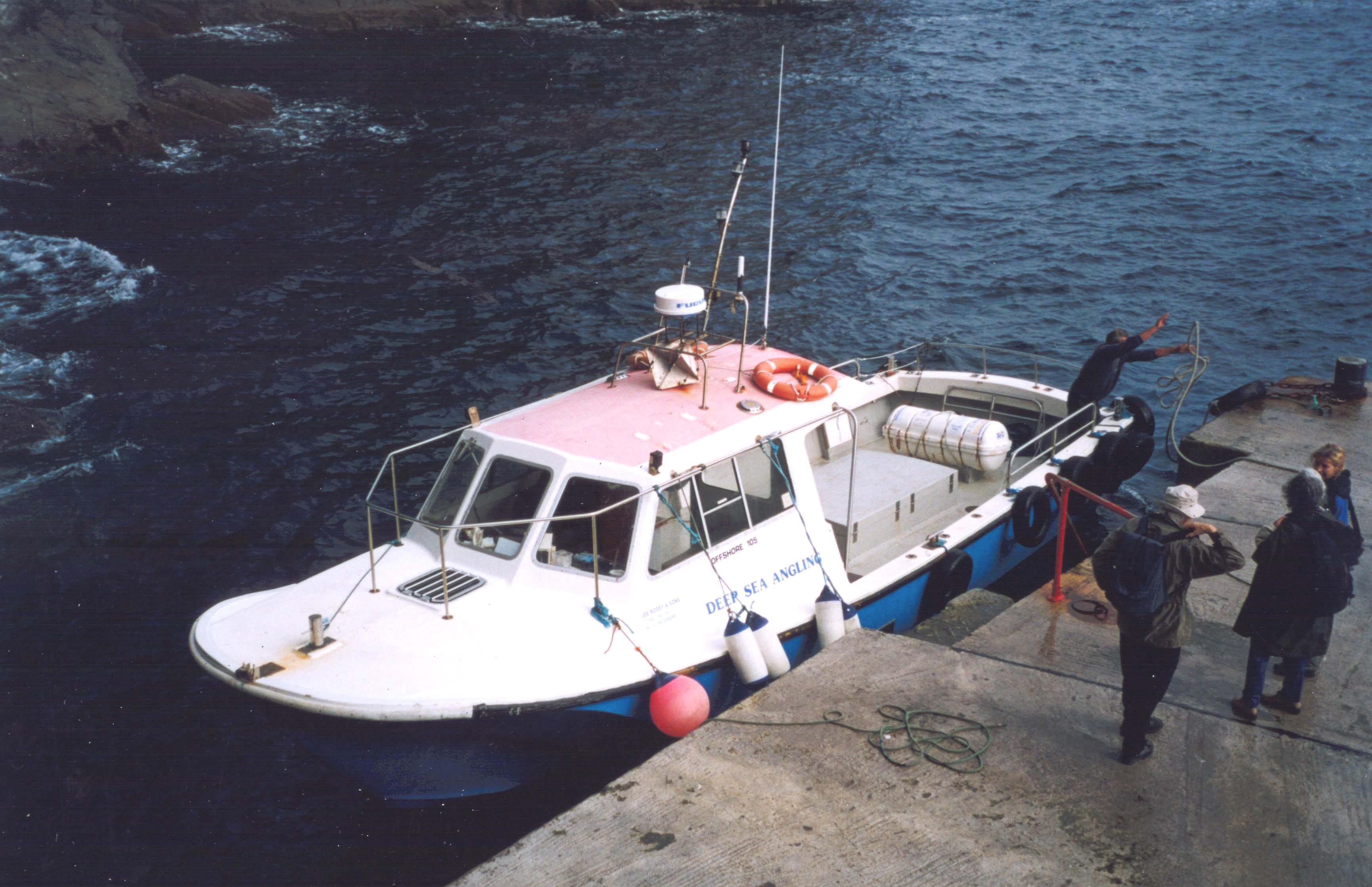
On Aug.22, 2004, Doreen and I disembarked from the lobster boat at a small jetty in Blind Man's Cove, one of the few sheltered places anywhere around Skellig Michael. Over the internet (ken@skelligtrips.com) we had booked passage for this date with Ken Roddy but had allowed ourselves several subsequent days in case the weather cancelled the trip as it frequently does. As soon as we landed at Cork Airport on the evening of Aug.21, I called Ken who informed me that the forecast for the next day looked good; it might, indeed, be the best day for the coming week and maybe the only one. This accelerated our schedule and we left Cork at 6.00am the next morning to drive to Portmagee at the far end of the Iveragh Peninsula on the Ring of Kerry. Ken was waiting at the pier and, with about 10 other intrepid tourists, we soon boarded his lobster boat for the ocean crossing.
We left Portmagee about 10.30am and were soon pitching up and down in the Atlantic as we emerged from the Portmagee Channel and the shelter of Bray Head. The Skellig rocks were now clearly visible but still eight miles of ocean away. The sealife immediately signalled that we had left the dominion of man for seabirds flew by in elegant formation and dolphins raced to play alongside our boat, leaping in the air just feet away as if to inspect this latest group of adventurers. Over the next hour the Great Skellig loomed ever larger ahead of us. In the lee shadow of this spectacular rock we could see one of the rock staircases that seemed to climb straight up the cliffs to the soaring summit. And soon we entered the tiny inlet, Blind Man's Cove, where a natural landing place has been supplemented by a small concrete pier. The boat rose and fell so that good timing was needed to safely step from the boat onto the pier. It was all done rapidly and soon the boat moved out and away from the dangerous rocks to wait in the open ocean while we explored the island.
 | 
| |
|---|---|---|
| Approaching Skellig Michael | On the lighthouse road |
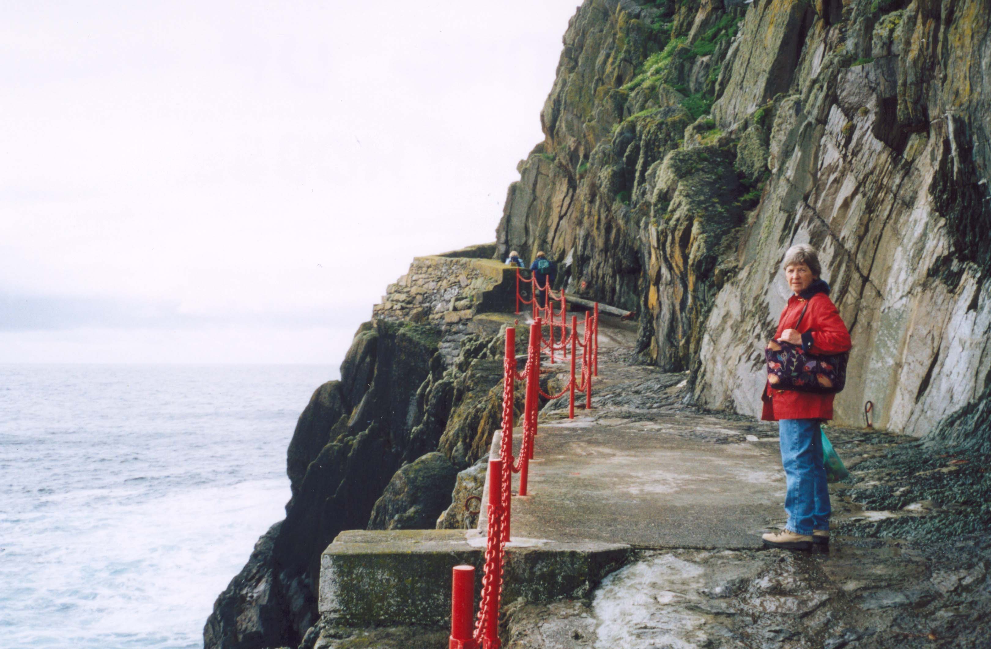
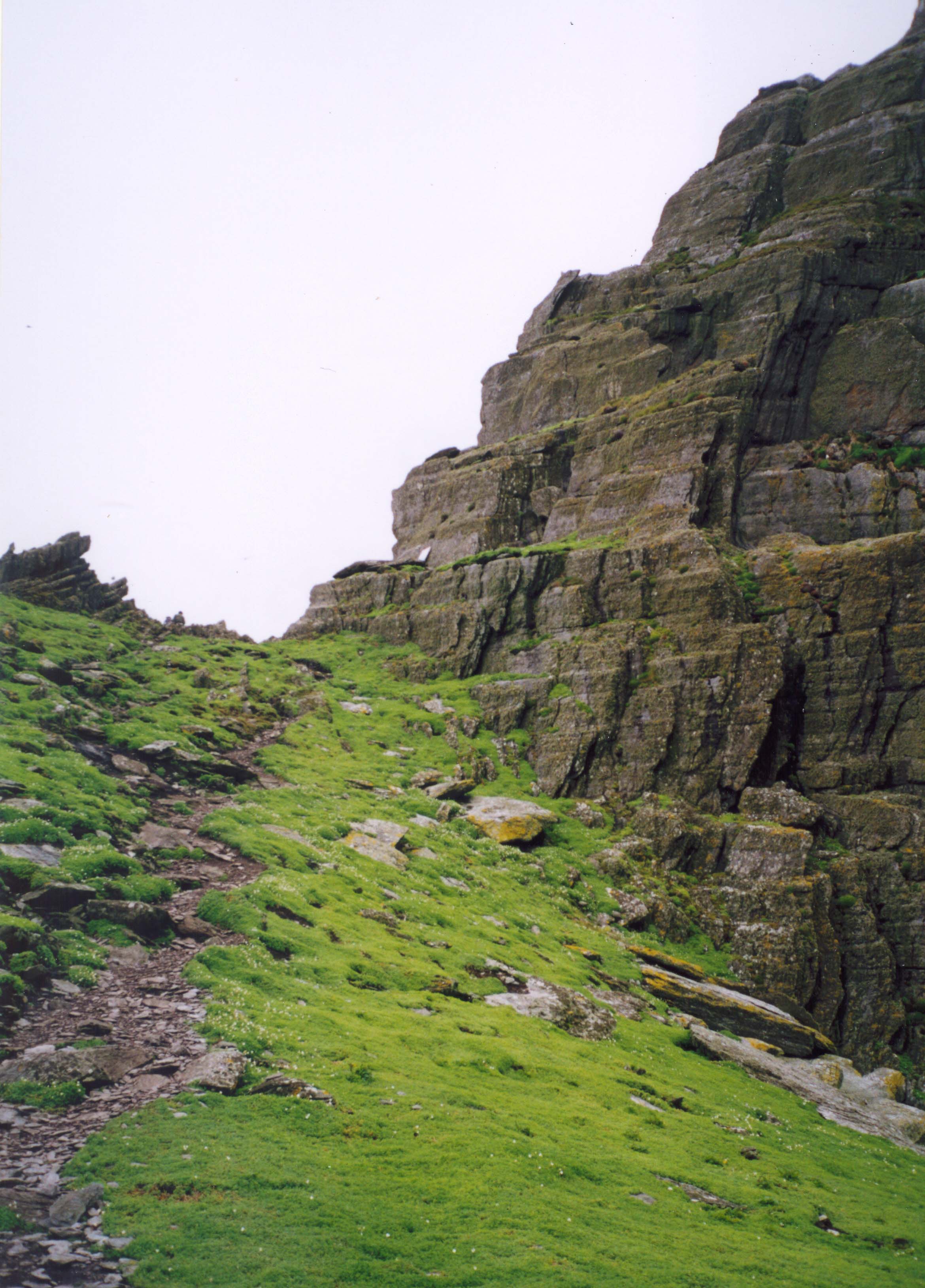
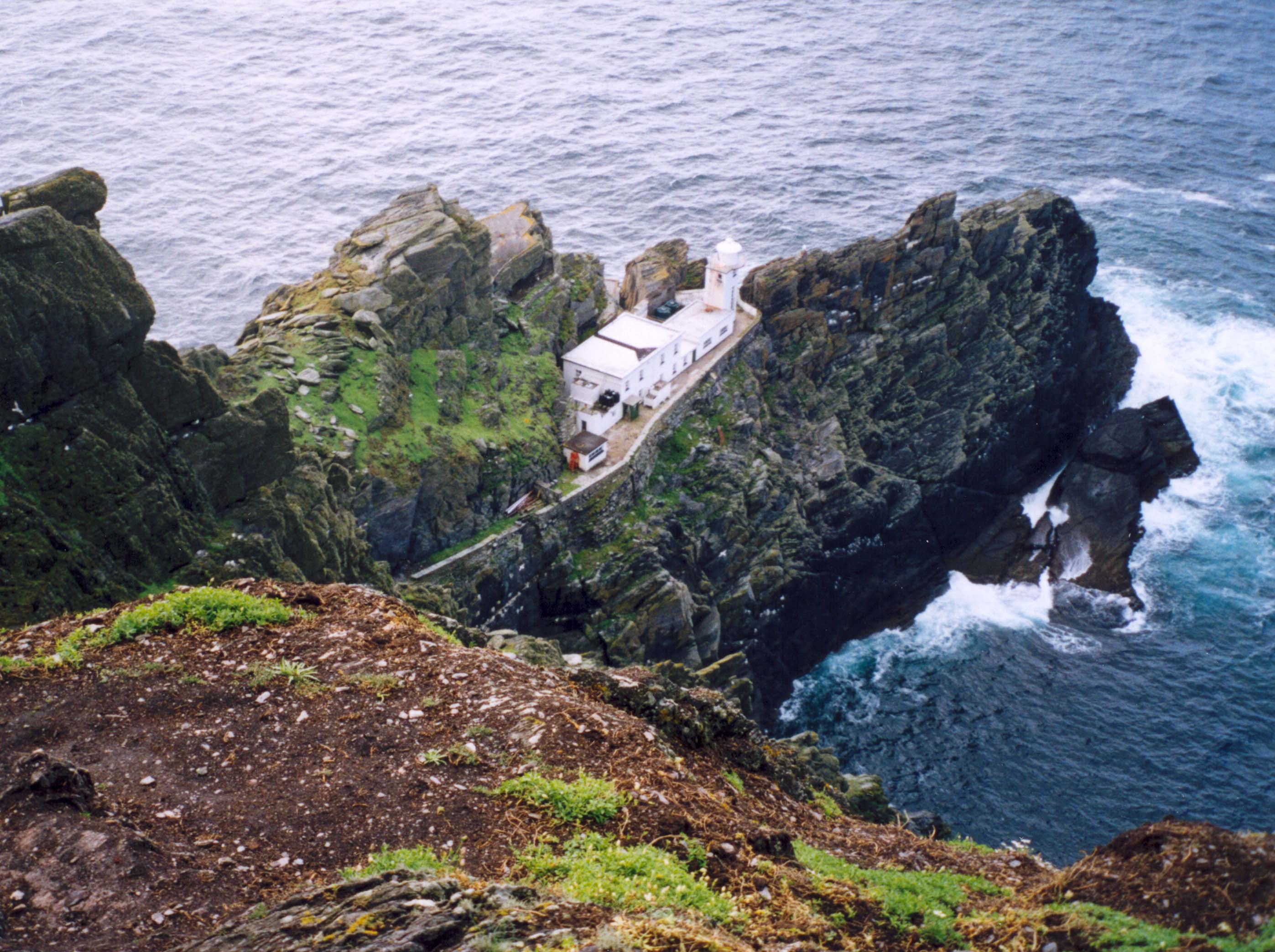
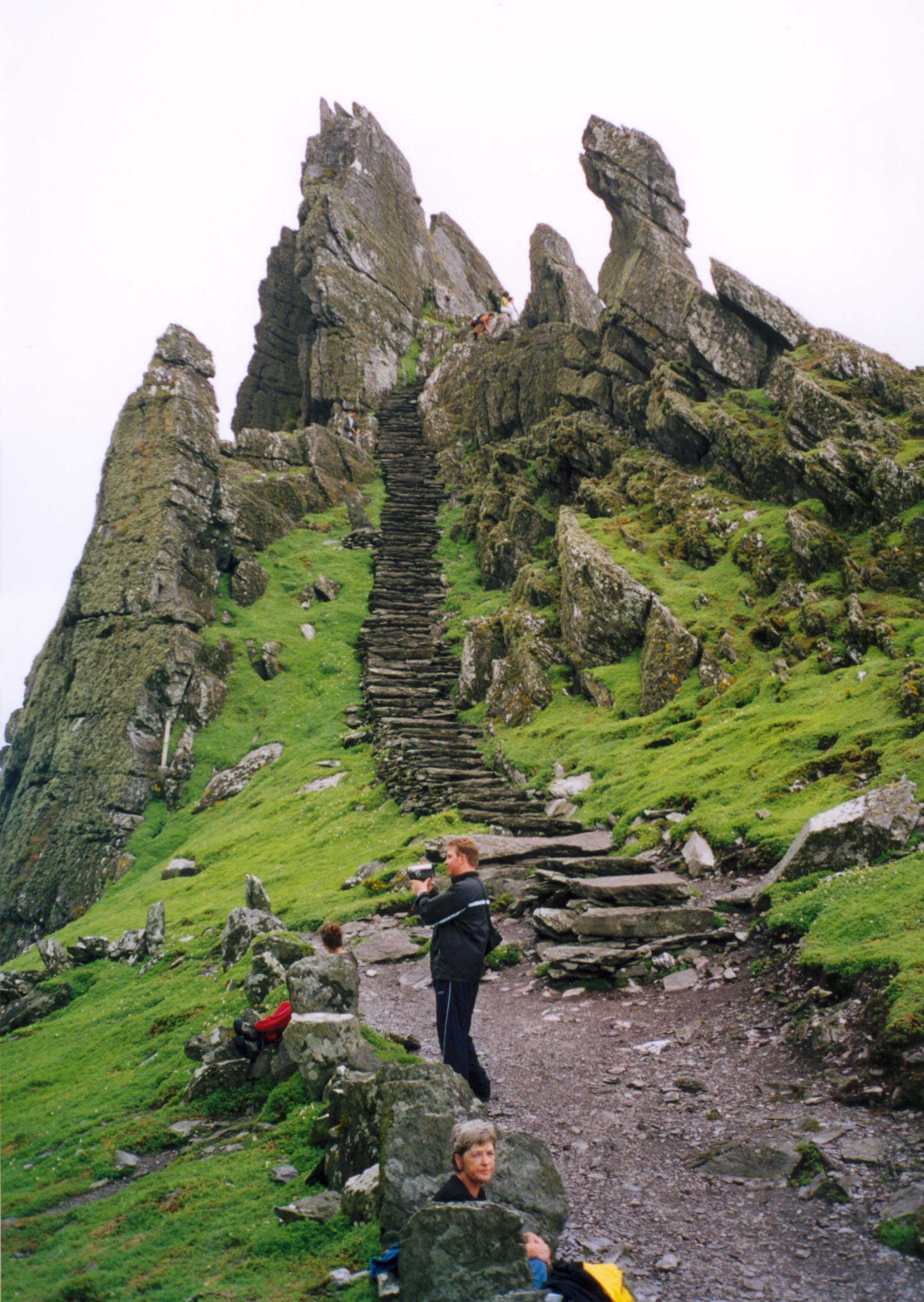
When the lighthouses were built in the 1820s a narrow road was blasted out of the cliff to allow access from Blind Man's Cove to the lighthouses at the far end of the island. Following this easy path, we contoured around high above Cross Cove and passed the steel helicopter landing pad built in mid-air overhanging the sea. About 400yds from the boat we came to the point where the lighthouse road intersects one of the monk's stairways, the South Trail that zigzags 500ft up from the South Landing to Christ's Saddle. The monks built several other stairways, one directly up from Blind Man's Cove to the monastery and another from the Blue Cove on the north side up to Christ's Saddle but neither of these are practical or safe for today's tourists.
Just a short distance up the stairway from the lighthouse road is the Wailing Woman, a projecting rock formation of odd and haunting form. In times gone by, she was one of the penetential stations of the cross on the way to the heights above. To the secular visitor today, she seems to stand guard, testifying to this special place of myths and spirits and reminding the visitor that their stay is brief and insubstantial. Beyond this guardian, the stairway steepens and the view down to the ocean becomes increasingly intimidating. Eventually, the stairway edges into Christ's Saddle, 400ft above the waves. Here, Doreen and I paused to rest in the reassuring but tiny area of flat ground with great cliffs above and below.
 | 
| |
|---|---|---|
| South Peak, Skellig Michael | Approach to South Peak |
Here, too, Doreen was kind enough to wait, kind enough to indulge me while I fulfilled my ambition to leave the normal tourist trail and climb the daunting, 715ft South Peak. Several centuries ago the South Peak became the destination of pilgrims determined to visit the stations of the cross all the way to the summit of this awe-inspiring peak. There they would edge their way along an overhanging rock known as ``The Spit'' to kiss a standing stone perched on the end. That stone fell into the ocean some years ago but the magnetic pull of the South Peak has not been reduced as a result. Apart from the spectacular views and the excitement of the climb, there are the remains of the tiny hermitage built on a ledge high up on the South Peak perhaps a thousand years ago. It is even more awesome than the view.
 | 
| |
|---|---|---|
| South Peak Trail | Lighthouse from trail |
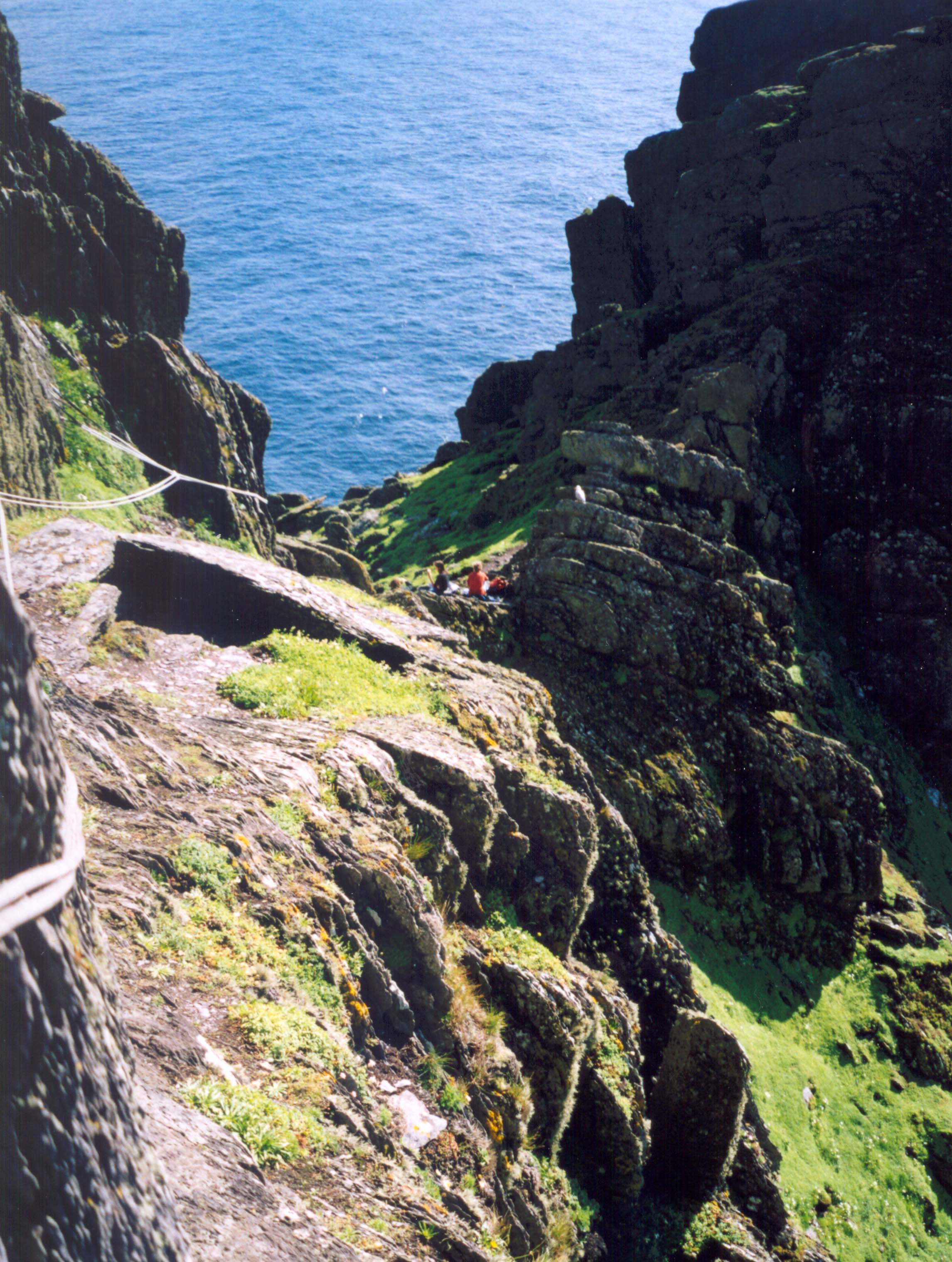
A left fork at Christ's Saddle took me up to a narrow ridge that connects the South Peak with an outcrop of rocks to the southwest. From there one accesses an improved ledge that contours around to the western side of the peak. Here I found that ropes had been strung along the ledge as a safety railing though they were not essential. The ledge trail ends about 15ft below a large perched boulder seperated from the mountain by a narrow defile called the Needle's Eye. Scrambling up the rockface below this feature, I had little difficulty in climbing up through the Needle's Eye. Indeed there are convenient footholds that may have been cut into the rock centuries ago. One surmises that the Needle's Eye may have allowed the South Peak to serve as a safe refuge since a few men could guard the Eye against a host of raiders.
 | 
| |
|---|---|---|
| Oratory Terrace | Monastery from South Peak |
Emerging from the top of the Needle's Eye, one is rewarded with an awesome view. Just below on a rock outcropping is an ancient enclosure whose purpose is difficult to imagine; far below that are the ruins of a more modern structure, the remains of the second, upper lighthouse now long abandoned. Turning around to face the peak, one recognizes a steep but easy climb up a slight gully with many good footholds. Forty feet up you emerge onto the end of a flat ledge known as the Garden Terrace. This ledge seems natural but it is in fact of human construction being supported underneath by hidden, man-made retaining walls; it may or may not have served as a hermit's garden. The ascent resumes back at the northwestern end of the Garden Terrace where you continue to climb up the rockface for about 20ft to a comfortable path. In the southeastern direction this path leads down to the most important archeological site on the South Peak, namely the Oratory Terrace. Here one finds, among other relics, the remains of a small oratory built by the monks. Clearly this was intended as much more than a station for short visits, because an intricate system of water collection has been chipped out of the rockface and terminates in two inconnecting water basins. It is an awesome place with an incredible view and causes one to marvel at the human spirit.
The summit of the South Peak is only about 45ft above the Oratory Terrace. To reach there you retrace your steps up the ledge leading to the Terrace and past where you ascended from below. The ledge leads into a corner where, with the aid of good foot and hand holds, you can climb last 15ft to the summit. The peak itself is adorned with a modern iron weathervane but the eye is soon drawn to the incredible spectacle in every direction. Almost directly below you on the east is Christ's Saddle and to the northeast you see, for the first time, the lower rounded peak and the tops of the beehive cells that constitute the monastery. On the north and west the cliffs drop straight down to the ocean waves, while the upper and lower lighthouses are visible to the southwest and south. It is a special place to have the privilege to visit and one can readily understand how it became a place of pilgrimage.
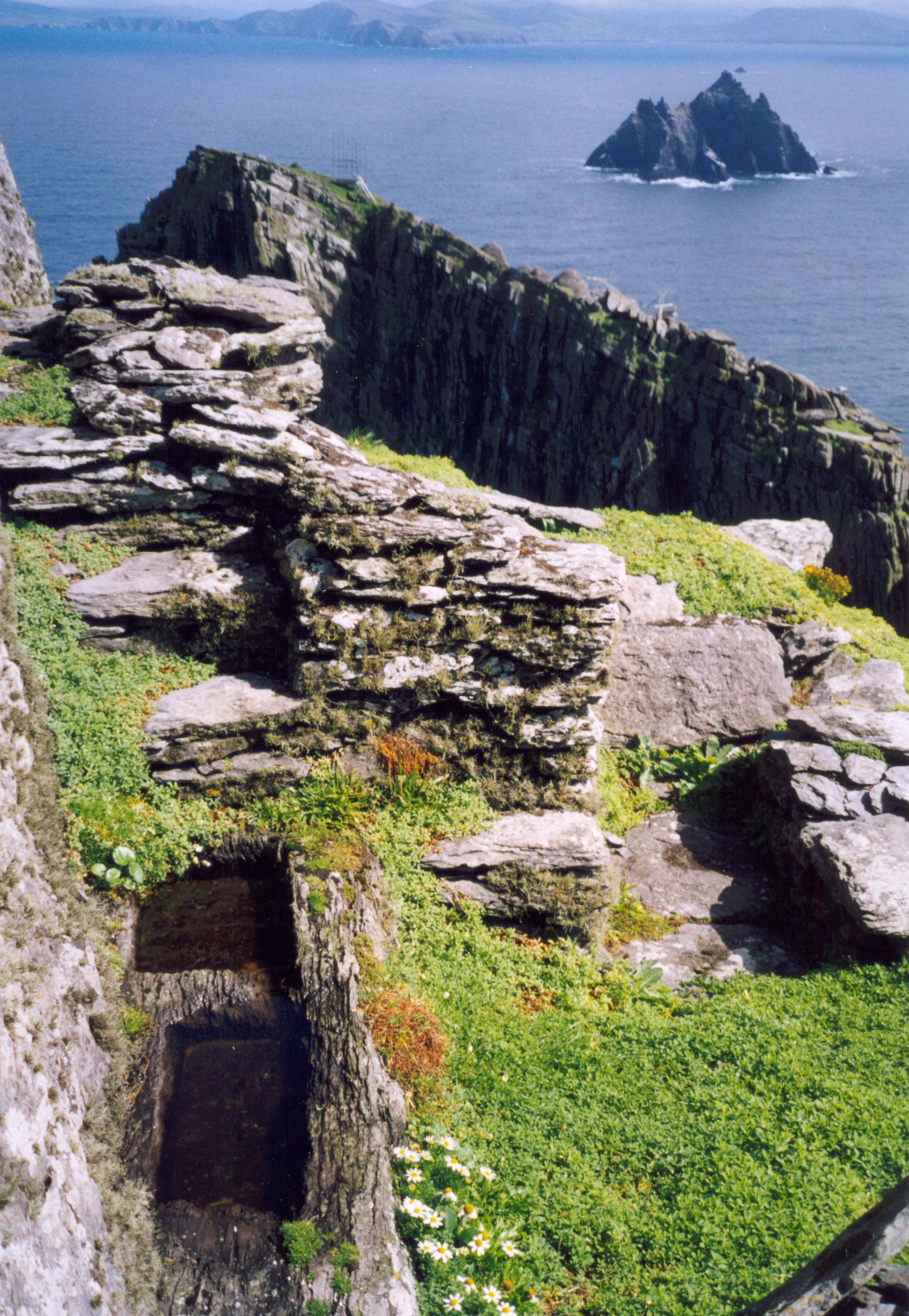
Reluctantly I dragged myself away from the summit and quickly descended to Christ's Saddle where I rejoined Doreen. From there we climbed the last steep stairway that leads to a ledge trail with an enormous 600ft of exposure down to the ocean waves. Traversing this ledge trail, brought us to the doorway through the first curtain wall just below the monastery. The curtain wall encloses a courtyard that overlooks other clearings and small structures right at the edge of the cliff. We spent a few moments here getting our breath and admiring the marvellous sea vista before us. Little Skellig dominated the seascape and the tens of thousands of seabirds that roost on that island made it appear like a great white bee's nest. The rugged southwest coast of County Kerry completed the backdrop which, on this day was blessed by a blue sky background.
 | 
| |
|---|---|---|
| Stairs from Christ's Saddle | Monastery |
A massive dry stone wall protects the monastery on this southeastern side and access to the inner courtyard is by way of a tunnel doorway through this great wall. Climbing up the steps at the other side one is greeted by the line of six beehive structures with their corbelled stone roofs. These beehive structures have a square planform inside and a circular one outside. A set of projecting roof rocks allowed the monks to climb to the top of the structure and open or close a rock that covered the top of chimney. Only one roof is missing and it may well have been dismantled by the monks themselves. Between the line of beehive huts and the great wall the courtyard is filled by one in tact oratory, the ruins of a more modern church, the Church of Saint Michael, and a tiny graveyard with gravestones and a large celtic cross. The older intact oratory is similar in structure to the beehive cells except that it has a rectangular planform both inside and out. A window and a doorway of the Church of St. Michael still stand though much of the rest is gone. One lighthouse keeper buried two of his infant sons in the church and covered their graves with an inscribed gravestone. But this is the only modern incursion that has been allowed to remain. It is indeed a wondrous place, a treasure preserved by isolation. Doreen and I ate our lunch and listened as one of the docents told us what little is known of those remarkable dark age inhabitants.
Too soon, however, it was time to take our leave, to struggle down
600ft of ancient stairway back down to sea level. Descending was in
some ways more of a challenge than ascending for looking down at the sea
so very far below us was seriously intimidating. However,
we made it slowly but surely.
We had been told to meet the lobster boat back at the jetty at 2.00pm
after 2.5hrs on
the rock; everyone was there on time and quickly boarded the boat for the
return to the mainland. As the boat drew away from the island, we
looked back in admiration at the imperfect refuge of those ancient
hermits, marvelling at
the unquenchable spirit they needed to survive in this awesome place.
Last updated 9/20/04.
Christopher E. Brennen