THE FAR SIDE OF THE SKY
© Christopher Earls Brennen
CHURCH ISLAND
``Where you weren't known and far from what you knew:
The lowland clays and waters of Lough Beg,
Church Island's spire, its soft treeline of yew''.
From "The Strand at Lough Beg" by Seamus Heaney.
These fifty stories began in my childhood home of southeast County Derry and it is appropriate to end them there with the story of a hike long delayed. As a young boy one of the mystical places near to my home village of Magherafelt was an island in a small shallow lake called Lough Beg. The river Bann drains the largest lake in the British isles, Lough Neagh, starting at Toomebridge just a few miles northeast of Magherafelt. It flows north eventually reaching the sea on the north coast. But just a couple of miles north of Toomebridge it widens briefly to form a much smaller lake called Lough Beg, some 3 miles long and one mile wide. (Geologists tell us that our iconic and storied river, the Moyola, once drained into Lough Beg but that a long-forgotten flood changed its course so that it now empties into Lough Neagh.)
Close to the west Coast of Lough Beg is a small island called Church Island with the ruins of an old church and a history of religious activity. Local legend has it that St.Patrick visited the island in the fifth century and, kneeling in prayer, left an imprint in a stone known as the Bullaun Stone. That stone has a hollow that holds water and today remains a object of reverence. What is better established is that a man called Thaddeus came to the island where he founded a church and monastic settlement; the traditional name for both the island and the church is Inish Taoide, Toide being Irish for Thaddeus (Thaddeus is said to be buried against the inner wall of the church). Since the Vikings sailed up the Bann on their raids of Irish settlements, it is unlikely that Inish Taoide escaped their predations. However it survived and is mentioned in the Annals of Inis Fallon in 1112 and in the Annals of Ulster in 1129. In later years the monks were of the Dominican religious order. Traces of herbs and rare mints grown by the monks for cures are still found there today. The Church on the island acted as the parish Church until it was burned down during the plantation of Ulster; by 1603 the Church was nearly in ruins. In the year 1642 the Church, already close to ruin, was taken over by the military and a regiment of soldiers was billeted there. One of the officers by the name of Payne-Fisher wrote a brief, poetic description of the church:
And lodged the living among the dead.
Without we keepe a guard within
The chancells made our magazine.
Soe that our Church thus armed may vaunt
She's truly now militant."
Despite its ruined state, the church continued to play a role in the religious life of the local Catholic community. Mass was often celebrated within the roofless walls of the ancient Church. Close by the Bullaun Stone is a tree on which pilgrims, having prayed or made a wish, would hang a piece of cloth or other memento. Moreover Catholic burials continued there until the 1930s and gravestones are still extant. During the 1798 Rebellion, many women and children were forced to take shelter on the island. The feast day of St. Thaddeus falls on the September 7 and an annual pilgrimage to the island in honor of the Saint still takes place on the first Sunday in September.
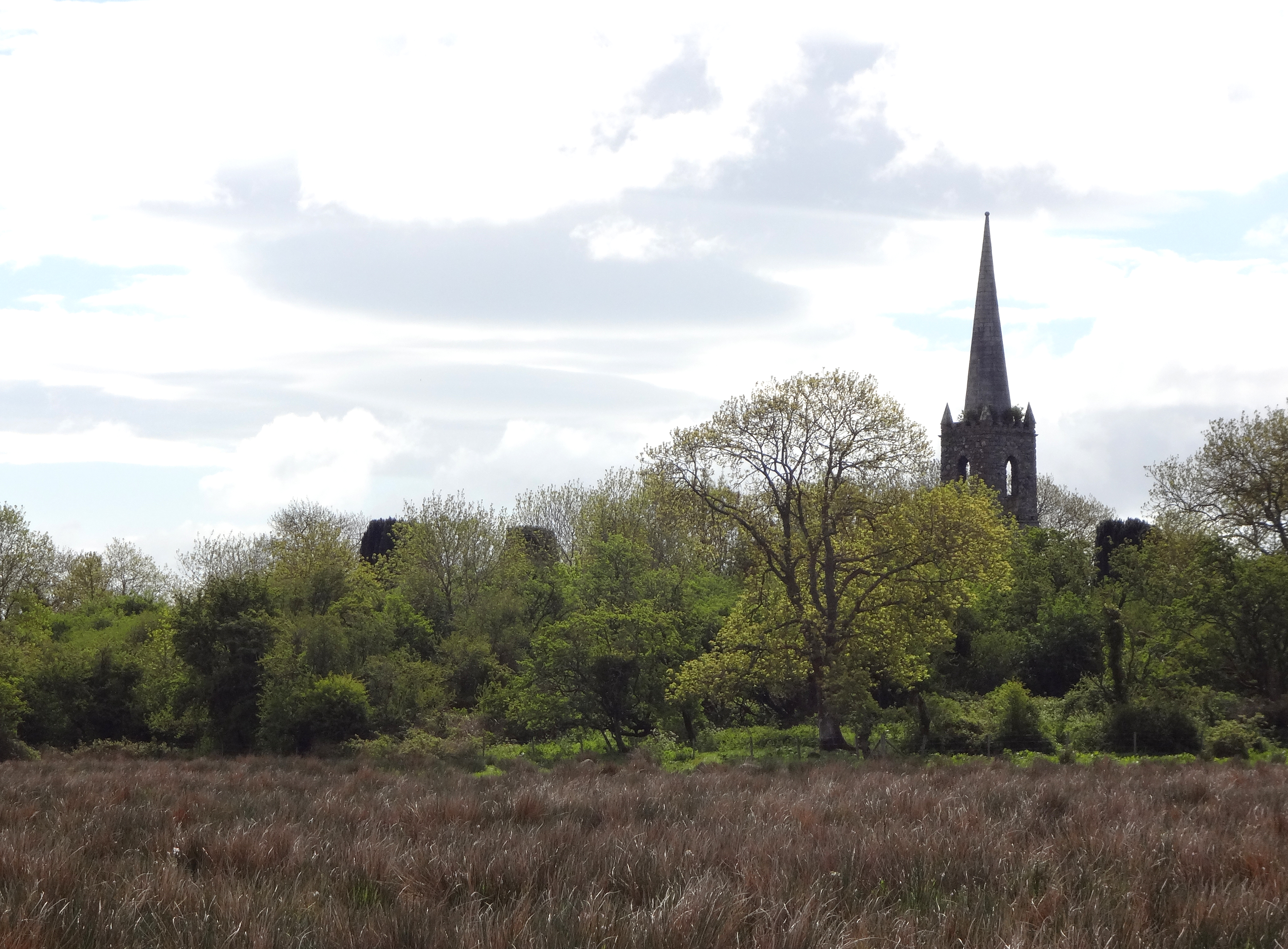
In the 1700s the eccentric Earl of Bristol, Bishop of Derry (also known as Bishop Hervey), constructed a mansion in Ballyscullion on the County Derry side of Lough Beg. To improve his view of Church Island and Lough Beg, in 1788 he commissioned builder Michael Keenan to add a spire to the church ruins. This spire, known locally as Herveys Folly, still stands and has become an iconic part of the Lough Beg landscape. During World War II an American aircraft based at the nearby Creagh air-base put a pronounced kink in the steeple when it hit it with its wing tip. It has since been partially straightened by the Department of the Environment.
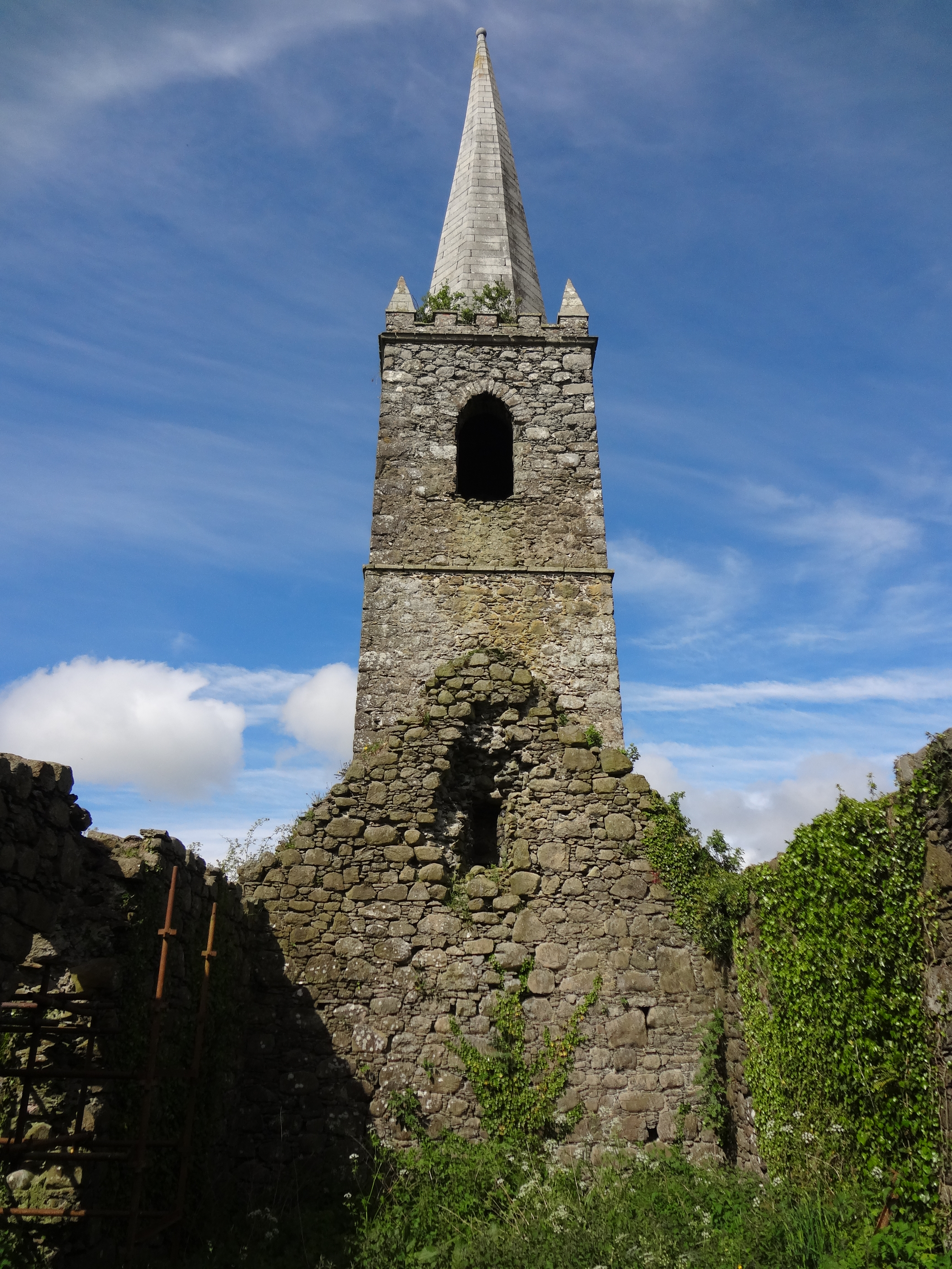
The walls of the roofless medieval church still stand though they are in need of conservation. The building is oriented east/west and measures 52ft by 21ft with a door on the south side and windows at both ends and at the sides. The walls, built from local stone, are about 3ft thick. The church lies in the middle of a graveyard with about fifty known graves and a number of gravestones on both the north and south sides of the church (the gravestone inscriptions have been recorded). The graves include that of Michael Keenan, the builder of the steeple.
Church Island consists of seven acres of land much of which is wooded. While it was an island in the old days, the dredging of the River Bann in the 1940s created a marshy wetland between the island and the west or County Derry side of Lough Beg. This low lying wetland can be crossed by foot except when a swollen River Bann floods the marsh and water completely surrounds the island. The wetlands which are known locally as The Strand cover over 300 acres (the second largest wetlands in the United Kingdom) and have become a haven for all kinds of birds, both resident and migratory. In 1965 they were designated part of the Lough Beg National Nature Reserve and an Area of Special Scientific Interest for their diversity of plant and animal life.
Church Island always held a fascination for me. I often asked my father if he would hike to it with me but, somehow, that never happened. In the intervening years Seamus Heaney's poem by that name reminded me of that unfulfilled ambition. And so it was, some 53 years after I left Ireland, that I found myself with a couple of days to spare during a brief visit to Magherafelt. My friend Eugene Kielt, lent me a pair of waders (essential equipment for this hike) and I set off one morning determined to finally make it to Church Island.
 | 
| |
|---|---|---|
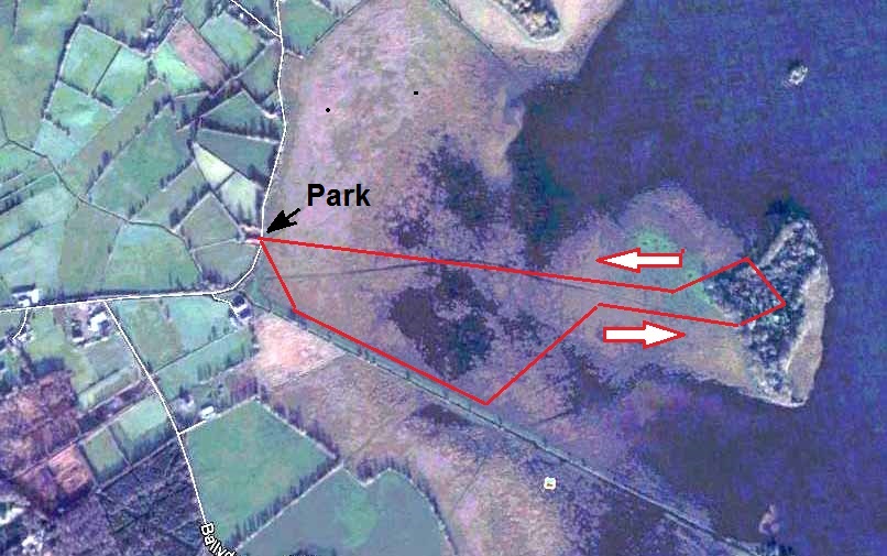
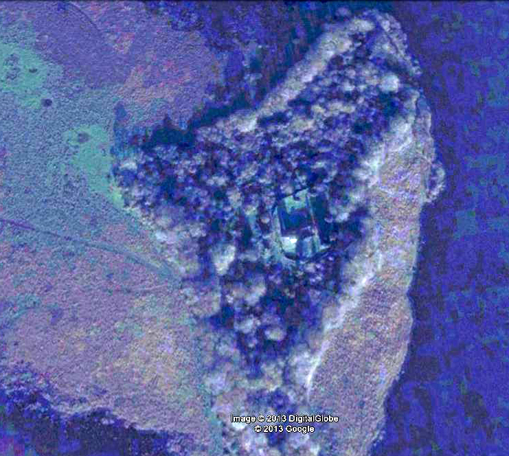
| Maps of Church Island in Lough Beg (with hiking route). | ||
The easiest way to get there from Toomebridge or Belfast is to leave Toome going west on the A6 and to turn right (at 54deg. 45.882' N, 6deg. 30.127' W) onto the B182 about 1.5 miles beyond Toome. Driving north on the B152 toward Bellaghy for about 2 miles you encounter a small side road, the Ballydermot Road (at 54deg. 47.513' N, 6deg. 30.617' W) where you should turn right. After about 0.5 miles you will come to a sharp left-hand corner from which you can see Church Island and its spire in the distance. It is not easy to find a parking space here but tuck in where you can. There is a stile over the bank (at 54deg. 47.511' N, 6deg. 30.019' W) that leads to the marsh and a sign describing the Lough Beg Nature Reserve. This is the starting point for the hike to Church Island.
Before setting out take a careful look around the Strand. A local farmer by the name of Arrell sometimes grazes his bull there. If in doubt about the bull, carry a stout stick (Eugene also lent me one of these). Absent the bull, it is still not easy to tell the best way across the marsh though the Google map view provides some clues. There is a dregded dike that runs from the nearby farmhouse on your right out in a direction to the right of Church Island. The footing along the raised bank of this dike is good but the problem is you must, at some point, leave the dike (at about 54deg. 47.350' N, 6deg. 29.647' W) to strike out across the marsh. The footing then rapidly deteriorates (the elevation of the marsh is less than 40ft above sea level). With each footstep you will sink about six inches into the water and mud making progress slow and strenuous. One tip is to step on the clumps of reeds rather ran try to avoid them. Eventually, as you near the island the footing gets better. On the return journey I took a different route striking out directly from the island toward the stile. Though still strenuous this proved a much better route. The hike across the Strand took about 30 minutes each way.
 | 
| |
|---|---|---|
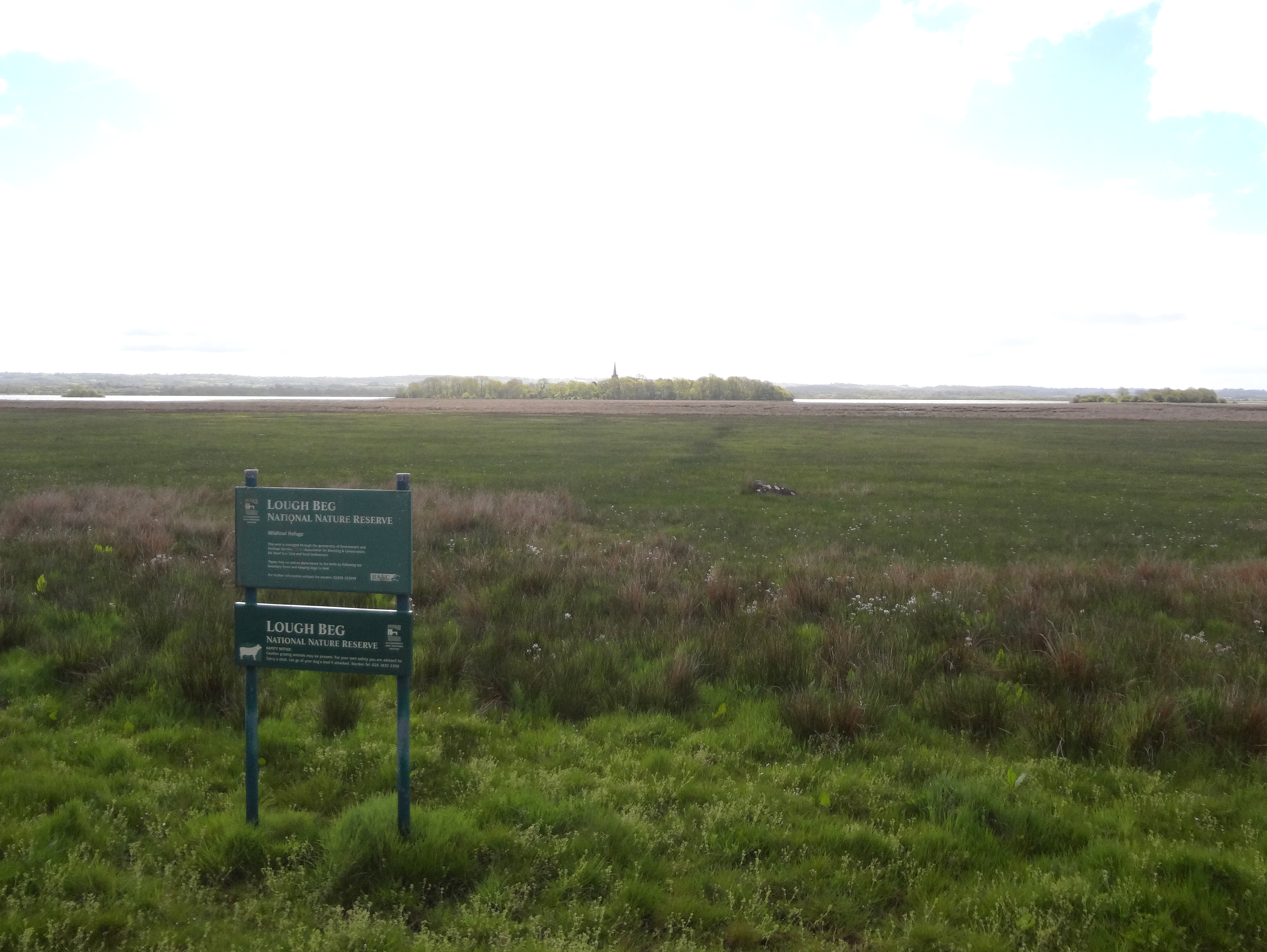
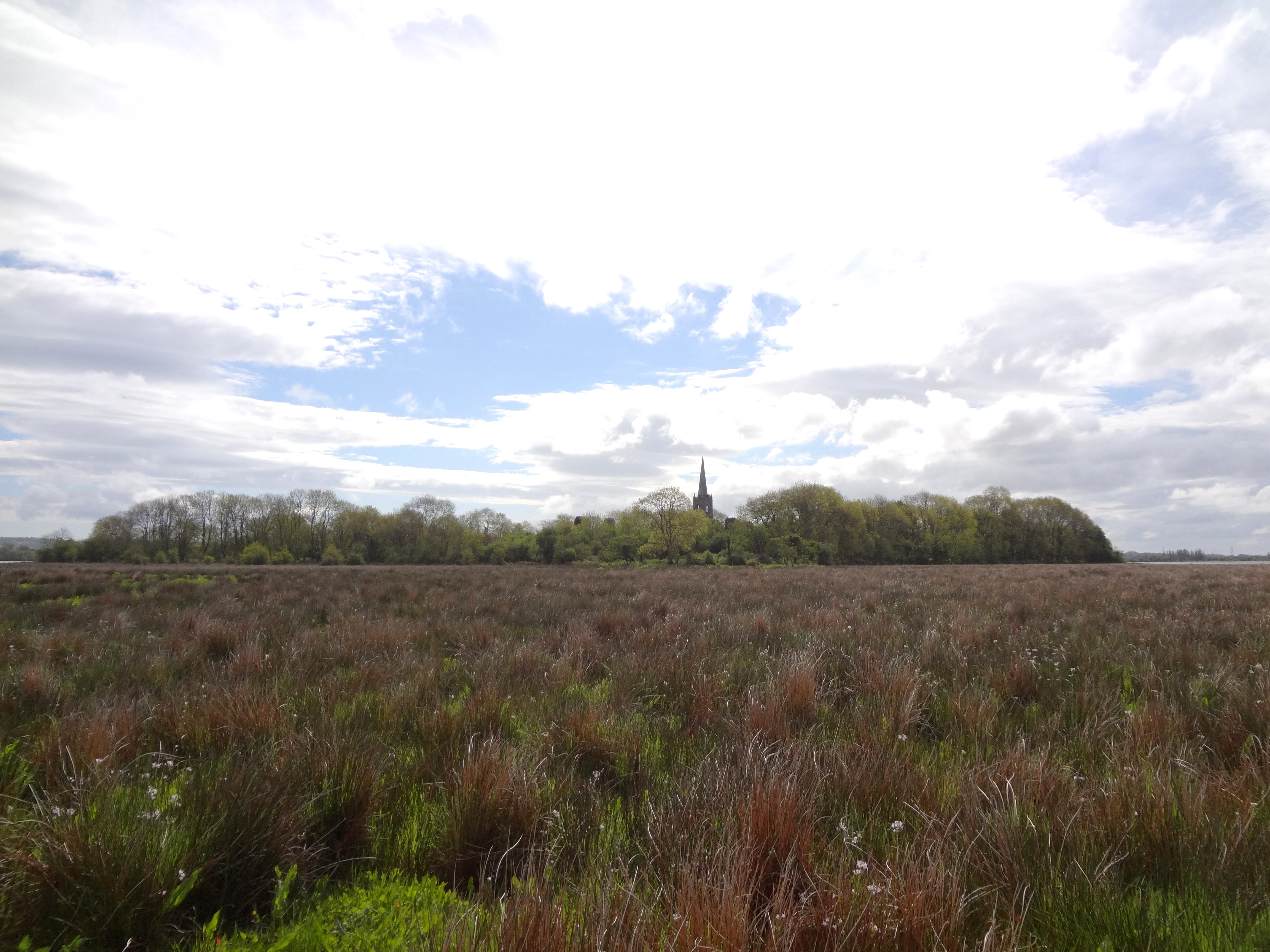
| Church Island from the road and halfway across the marsh. | ||
 | 
| |
|---|---|---|
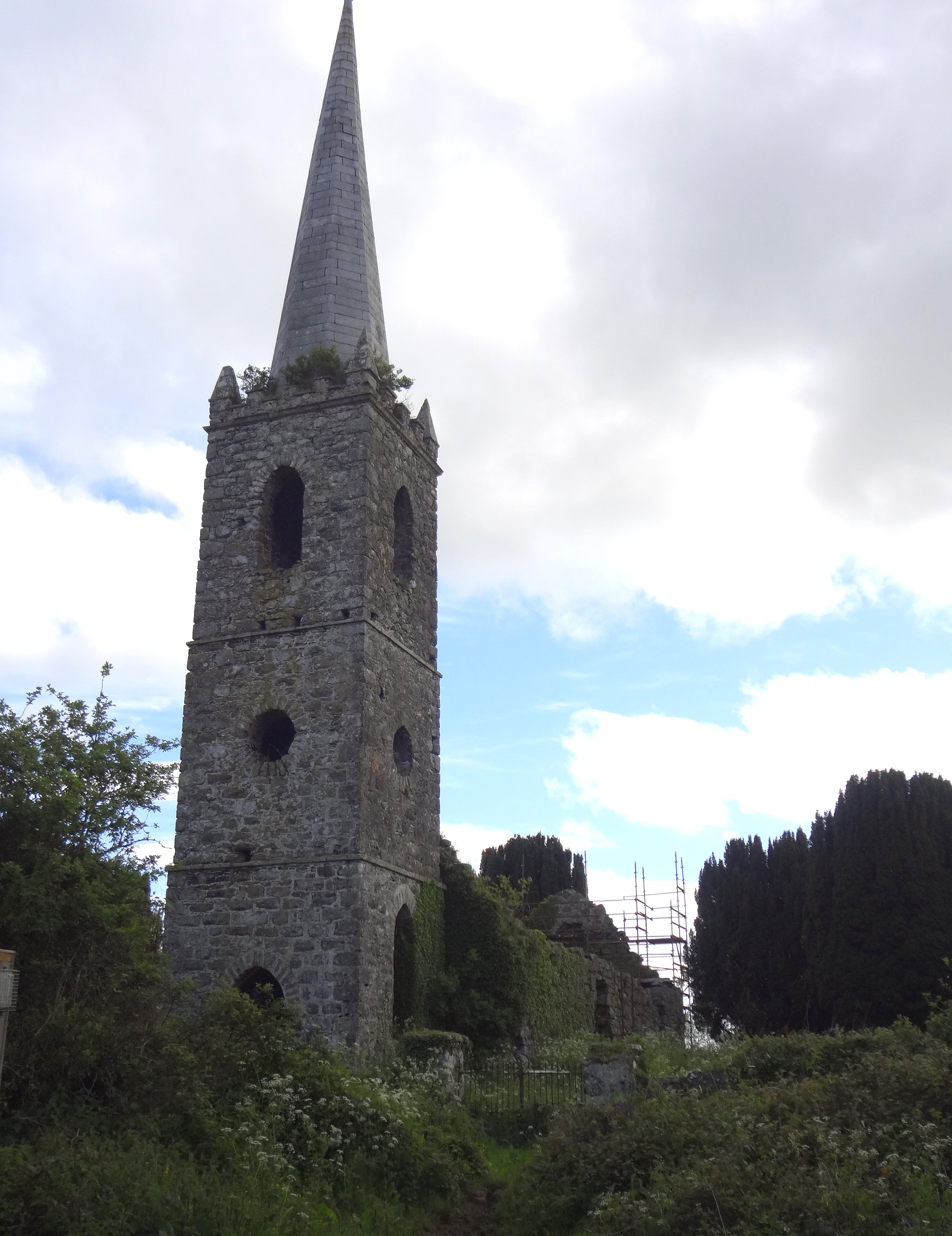
| Nearing Church Island | The Church |
The slightly higher ground of the wooded island (highest elevation about 54ft) is surrounded by a barbed-wire fence but, if you head for the church steeple, there is an opening in the fence and a use-path through the woods and underbrush to the churchyard. A stile allows you to climb over the wall surrounding the graveyard and church (at 54deg. 47.394' N, 6deg. 29.084' W) and worn paths allow you to access the church and gravestones. It is indeed a quiet and mystical place, shrouded in centuries of strife and tragedy. If stones could talk they would tell a myriad of stories, a minature version of Irish history.
 | 
| |
|---|---|---|
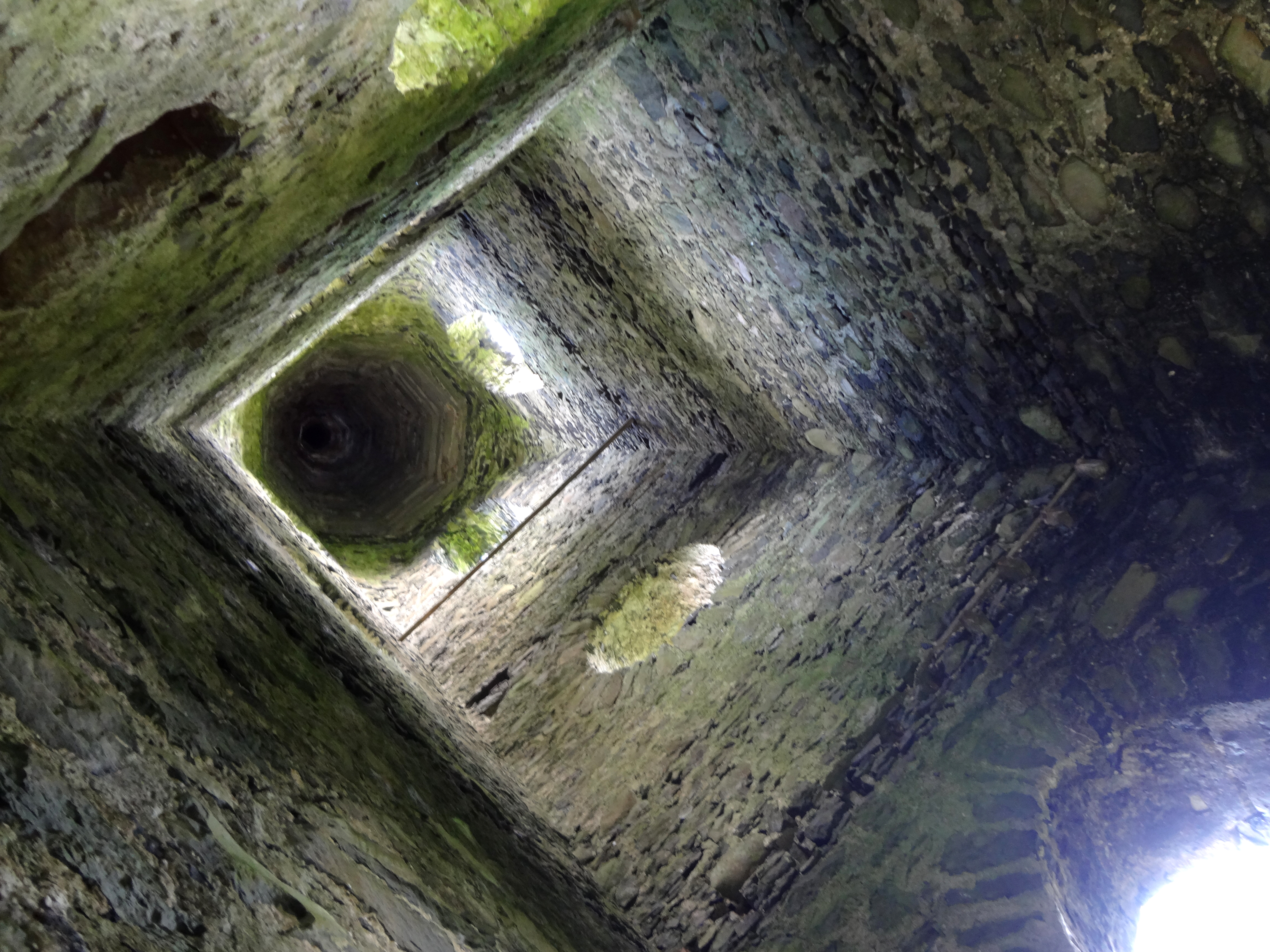
| Inside the church | Inside the steeple |
I thought of all the places I have been since the days of that first adventure on the Moyola. Now that my knees are finally failing me, it is possible that Church Island will be my last adventure. If so, I am satisfied for I have been privileged to enjoy some of the most beautiful places on earth while there was still some solitude to enhance them. I am also deeply grateful for the marvellous friends who have ventured with me for they lent the adventures a joy beyond measure.
As for Church Island, I hope that someday, this site will receive the attention it deserves from the conservationists. This will need to include some alternative way for visitors to get to the island. But this place is so rich in history, such an important part of the local heritage that it deserves
much more attention than it has received to date. I know that if such a place was located in my adopted country, it would be regarded as a national treasure and would have been protected and maintained with far greater care than it has been given so far.
Last updated 23/1/01.
Christopher E. Brennen