ADVENTURE HIKES AND CANYONEERING
IN THE SAN GABRIELS
© Christopher Earls Brennen

|
|---|

|
Hike E1. Bobcat Canyon
- Hiking time: 8.5 hours (one way) (9 hours to falls and back)
- Estimated hiking distance: 6.5 miles (one way) (5.8 miles to falls and back)
- Elevation gain: Minimal (2200 feet on return from falls)
- USGS Topo Maps: Waterman Mountain, Chilao Flat, Mt. Wilson, Azusa
- Difficulties: Several small rappels (one way hike), some bouldering
- Special equipment: Rappelling equipment with 100ft rope, 30ft of webbing and 2 rappel rings (for one way)
-
ACA Rating: 3A IV

Characteristics
Bobcat Canyon provides several different levels of adventure. It can be explored during an out-and-return hike that descends the upper section of Bobcat. This is a fairly easy, off-trail experience into an infrequently travelled canyon. About four hours of hiking down the canyon will bring you to a waterfall that is impassable without rappelling equipment; this is at the limit of an out-and-return day hike.
With rapelling gear, it is possible to continue on down Bobcat Canyon to the point where it joins the West Fork of the San Gabriel and then to hike up the West Fork to the place where the Shortcut/Rincon Fire Road crosses the river. This loop hike requires two vehicles and the preparatory placement of the return vehicle.
Trailhead
The trailhead for this hike is the large dirt clearing and overlook known as Windy Gap on the Angeles Crest Highway about 1mi west of Charlton Flats at 34o17.10'N 117o59.57'W. This overlook at an altitude of 5111ft looks down into the heads of three different canyons. In the hike entitled ``Devil's Canyon Loop'' we describe emerging from the easternmost of these three, a gully we have called Skull Canyon. Bobcat Canyon is the westernmost of the three canyons and travels south from here to join the West Fork of the San Gabriel at a point near the upper limit of the waters of Cogswell Reservoir.
If the intention is to complete the one-way hike from Windy Gap to the West Fork of the San Gabriel then a return vehicle must first be placed at the point where the Shortcut fire road crosses the West Fork. To do this, you will need to drive about 3mi down the Shortcut/Rincon fire road, a steep and rough dirt road that winds down from the Angeles Crest Highway into the canyon of the San Gabriel river. This is best done in a four-wheel-drive vehicle though a two-wheel-drive vehicle can make it. However, in order to access the fire road you must obtain a permit from one of the local US Forest Service offices. Along with the permit will come information on how to unlock the large iron gate that normally blocks entrance to the fire road.
To reach the entrance to the Shortcut/Rincon fire road you drive up the Angeles Crest Highway to a point 0.5mi beyond where the Upper Big Tujunga Road branches off to the left. Here, on the right, you will find the entrance to the fire road as well as information on the trails that branch from it. The fire road climbs very briefly and passes a water tank before beginning the descent into San Gabriel Canyon. It takes a little over 30min to drive down to the river crossing at 34o14.86'N 118o2.02'W and an elevation of 2760ft where there are several places to park.
Having placed the return vehicle at the river crossing, you should return to the Angeles Crest Highway and drive east another 2.7mi to the Windy Gap trailhead.
Hike
The first important step in this hike is to locate the trail that follows the top of the ridge on the east side of Bobcat Canyon. To do this, hike up the broad trail leading off to the west from the parking area. This climbs west toward the top of Mount Sally but you only go about 50yds up the trail. Just past a water tank, look for a trail that goes down through the bushes to the left (south). There are several such trails but they quickly merge as they converge on the apex of the descending ridge that begins to take form after about 50yds. There are, however, many forks and, to avoid losing the main trail, my advice is to concentrate on staying on the apex of the ridge. Soon there is only one wide, sandy ridge trail and you mostly descend, paralleling the uppermost reaches of Bobcat Canyon which lies off to your right. After 0.5hr you descend to a saddle (34o16.85'N 117o59.54'W and elevation 4960ft) where there is a large, open grassy area spotted with yuccas. Turn right here and descend into Bobcat by way of a use-trail down a small, brush-free gully. It is a brief descent and soon you are beside the small stream in Bobcat Canyon itself (34o16.83'N 117o59.61'W and elevation 4860ft). Proceeding downstream, there are several waterfalls to negotiate and it is fairly obvious whether to circumvent these on the right or the left. When I went this way in the winter there was running water for the entire length of the canyon but the upper reaches may be dry in the summer.
After 1hr 20min the canyon makes a clear turn to the right and, 25min later, you come to a junction where a substantial canyon enters from the right (a use-trail leads up this canyon). The going here is fairly easy with only occasional places where bushwhacking is necessary. In many places you can take advantage of a well-worn animal trail. There are also many small pools and falls to enjoy and reasonable shade for a summer day. A little over a hour later (2hr 50min from the start) you encounter another junction with a large canyon entering from the right. This comes directly down from Mount Sally and could be called Sally Gulch though there is no such name on the topo map. The elevation of this junction is 3400ft. Note that an altimeter is a good way to plot your progress down this canyon provided you remember to set it to the correct altitude at the trailhead.
Just 25min below this second junction (and 3hr 15min from the start) you encounter a tricky free climb. The obstacle is a small waterfall with steep cliffs on both sides. The climb down is easy though a little precarious. You descend from the left to a narrow rock ridge that sticks out into the canyon from that side. Climb down the apex of this rock ridge to the flat land below. Downstream is an overgrown boulder field where there are many comfortable places that could be used for an overnight campsite.
Downstream of the boulder field, the canyon narrows again and quite suddenly, at 34o15.21'N 118o0.40'W, an elevation of about 2900ft and a hiking time of 4hrs from the start, you encounter a substantial waterfall with a rocky pool below. This requires a rappel and is also as far as you can go on an out-and-return day hike. It takes 5hrs to hike back to the trailhead from here.
One Way Hike
The anchor for this first rappel is a substantial bush on the left near the lip of the waterfall. The falls descend 25ft into a large pool, that is immediately followed by a second drop whose height cannot be estimated from the top. In fact, this second obstacle is easier than it appears from above; it can be free climbed with little difficulty though you will need to wade through a second pool.
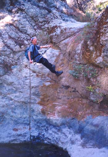
|
|---|
| Small rappel |
South of these falls, there is a long and flat stretch of canyon that is most easily hiked in or near the stream bed. Eventually you come to a place where the canyon makes a large and abrupt left turn followed immediately by a right turn where it also narrows dramatically. This is the entrance to the final narrows leading to the West Fork of the San Gabriel River. A short distance into the narrows and about 5hrs 45min from the start, you encounter a small, 20ft waterfall that necessitates a rappel. There is a convenient anchor in the form of a large rock in midstream. We note that, if travelling upstream from the West Fork, this small waterfall would be the end of the line for it would be difficult to ascend without technical rock-climbing equipment and expertize.
About 10min further, you come to dramatic twin waterfalls with a large, deep pool in between, almost enclosed by the surrounding cliffs. Both falls are vertical, the upper being about 30ft high, the lower about 25ft high. There are several large rocks at the top that could be used as anchors. The descent would clearly need to be done as a single rappel and would be enjoyable if you have sufficient time. However, if you are short of time as we were, there is a somewhat airy trail on the right that can be used to bypass this obstacle. A short distance downstream there are several small falls that can be circumvented on the left. Finally, 6hrs 15min after the start you will reach the end of Bobcat Canyon at the point where it empties into the West Fork of the San Gabriel (34o14.47'N 118o0.01'W and elevation 2420ft). The junction is readily recognized since the West Fork is a substantial stream throughout the year.
From this junction, you start up the West Fork and it is an easy 2.5mi hike back to the vehicle on the Shortcut/Rincon Fire Road. It is a very pleasant, wooded canyon with a bottom that is quite broad and open for most of the way. The use-trail becomes more and more evident the closer you get to the fire road. There are only two features that need to be noted. About 1mi from Bobcat Canyon, the canyon narrows and the use-trail climbs the north wall in order to bypass a large canyon-filling pool. On a bench on the right side immediately upstream of these narrows are the remains of an old trail camp; indeed there are many very pleasant camping spots along this stretch of the West Fork.
About 1.5mi from Bobcat Canyon, a substantial wash enters from the north and has deposited large banks of gravel in the middle of the canyon bottom. This has forced the main stream up against the south wall of the canyon. Coming from downstream, it is natural to be travelling on the bench on the north side of the stream and this could mislead you to follow the side wash thinking it is the main canyon. We travelled about 100yds up this side wash before realizing our mistake and backtracking to find the main stream.
The Shortcut/Rincon fire road
and the concrete ford it uses to cross the West Fork
(34o14.86'N 118o2.02'W and
elevation 2760ft)
are readily recognized and you should reach it about 8hrs 30min
from the time you left Windy Gap. The drive back up to the Angeles
Crest Highway takes about 30min and it would be wise to time your
hike so that this is completed before dark.
Last updated 7/30/99.
Christopher E. Brennen